

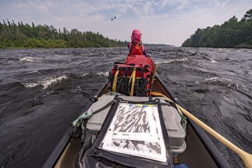
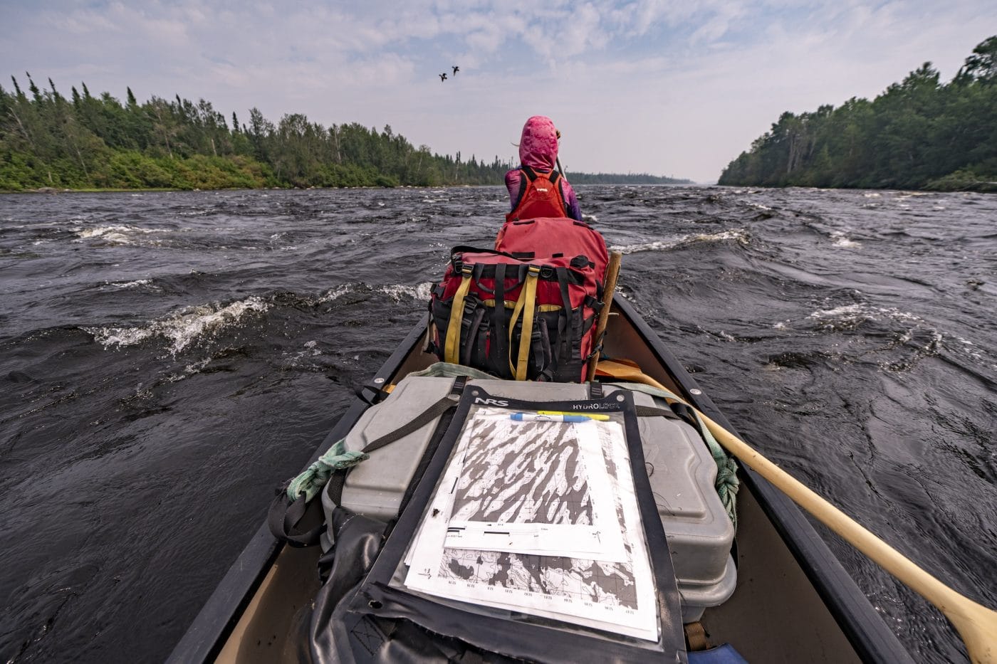
The Ring of Fire mining district is at the heart of the peatlands that sprawl across Treaty 9 Territory in far northern Ontario — and it is incredibly hard to get to. At least, without a helicopter or float plane.
When I first asked photojournalist David Jackson if he’d be interested in an on-the-ground assignment, reporting from the Ring of Fire, I thought he might have some logistical questions. I certainly did. But his response was a quick yes, followed by something along the lines of, “We’re planning to paddle that way in July.” Just like I might casually plan a few nights in Algonquin Provincial Park’s backcountry, David and his wife Leah were planning for 55 nights spanning more than 1,000 kilometres, following rivers and lakes from Armstrong, Ont., near their home, into the Ring of Fire and back.
But that plan changed.
Wildfires in early July rerouted them to launch in Sioux Lookout, Ont. Then a few weeks into their trip, word came in that the fire season was getting worse farther south. Paddling back was no longer an option, so they continued north, putting the fires — though not smoke — mostly behind them. The new course still took them through the Ring of Fire and nearby communities like Webequie and Neskantaga First Nation, but instead of a loop, it was a 1,700-kilometre paddle and portage, aimed toward the James Bay coast. A route across the Ojibway and Cree territory of Nishnawbe Aski, “the People and the Land.”
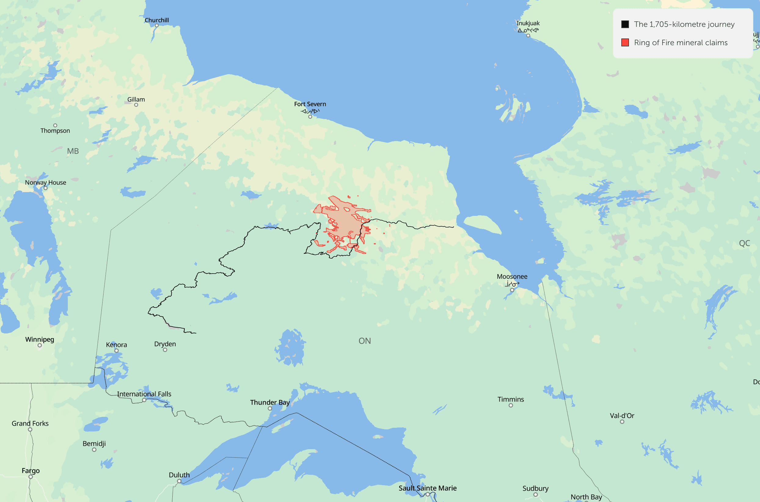
David and Leah’s 1,700-kilometre canoe journey took them from Sioux Lookout, Ont., to James Bay. Journey data: David Jackson | Mineral claims data: WCS Canada | Visualization: Andrew Munroe / The Narwhal. Map data from OpenStreetMap. Made with Protomaps, MapLibre and deck.gl.
They met people all along the way, most of whom were happy to talk. They saw moose, caribou and, unexpectedly, a polar bear far inland — near the western extent of the Ring of Fire mineral claims. A recent study by Wildlife Conservation Society Canada found that 86 per cent of the mineral claims within the peatlands that local Anishinaabe communities call “the breathing lands” overlap with areas critical for biodiversity and carbon storage. As the Ontario government vows to build roads to the region so that mines can move from exploration to operation, the ecological value of these lands as they stand now is important to remember. It’s why David and Leah planned to take this trip in the first place: to better understand the north as it is, from the people who know it best.
“It is really important to stop someone you see on a lake, or to offer tea or tobacco, accept their kindness, and share where you’ve been, where you’re going, because this brings the land to life,” David says. “The stories of people is the story of the Nishnawbe Aski. We are grateful to be visitors.”
I asked him to share some details about the trip that didn’t make it into his beautiful photo essay. Here’s what he had to say.
This conversation has been edited for length and clarity.
How do you go about preparing for a two-month canoe trip? Were you and Leah planning the trip months in advance and how long did it take to pack?
We had planned this canoe trip for the summer of 2025 but low water and spring wildfires diverted our travel to a different region. With a route already mapped, we only had to rework our starting point to account for the Collins wildfire. Waters were very high from a great snow pack, and we had enough vegetables, bean dips and moose meat dehydrated for two months of canoeing.
In early June, we printed hundreds of map pages, purchased a meagre six weeks of high-calorie food (especially things we didn’t expect to find in the Northern stores), and then got our gear organized to depart. The beauty of travelling in northern Ontario, or the Nishnawbe Aski, is that we could carry less food to lighten our portage loads and plan for resupplies in communities along the way. This also ensures we visit friends.
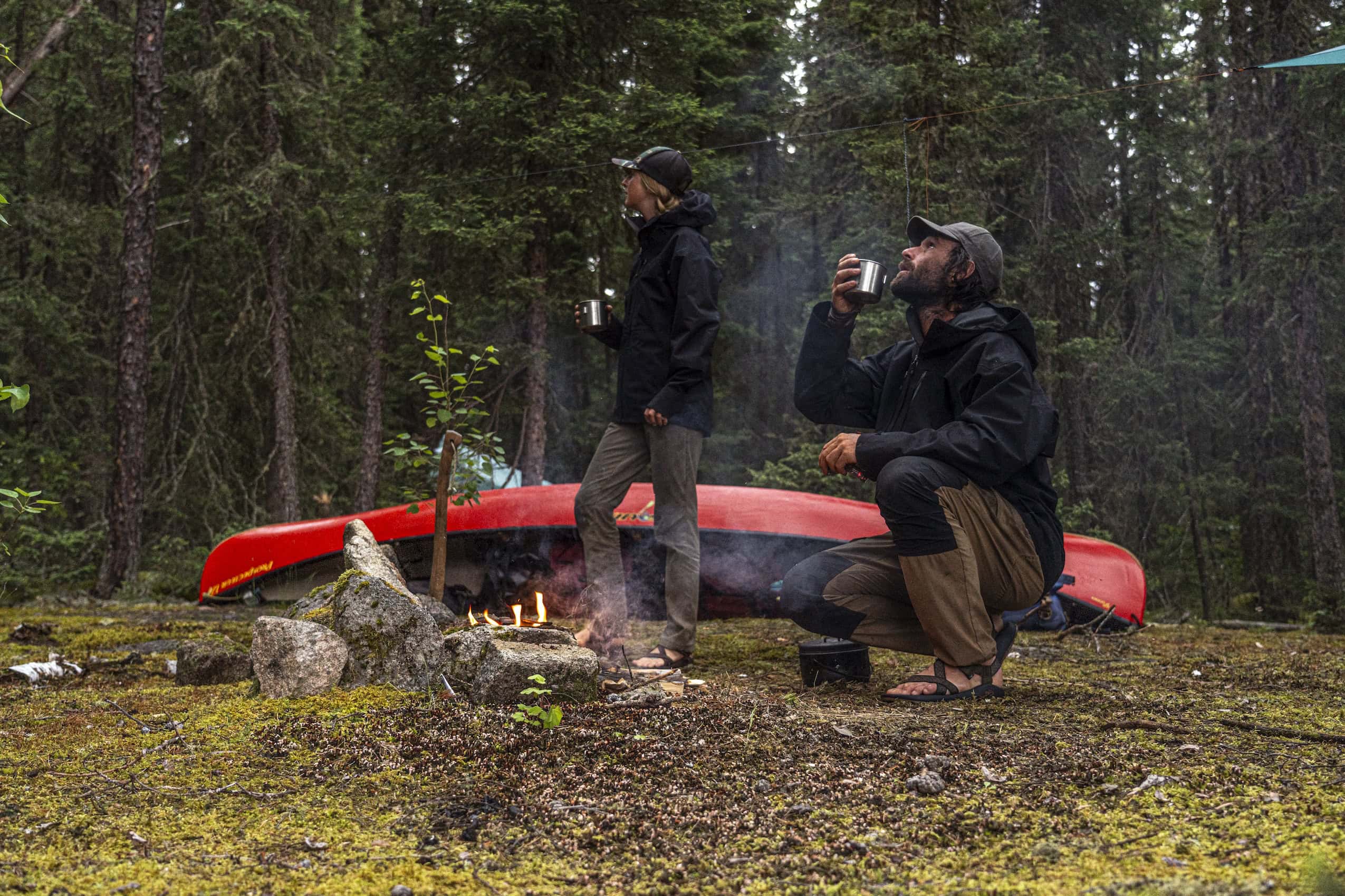
David and Leah Jackson brought enough vegetables, bean dips and moose meat dehydrated to last for two months of canoeing.
Do you have a favourite paddling meal — either for flavour or ease of preparing?
There’s no bad food when you’re hungry, but fresh fish tacos with tartar sauce or a hearty rehydrated moose parmesan pasta hit differently after a 12-hour day of travelling. We also eat a hearty homemade oatmeal every morning and it never gets old.
Do you bring any luxury items on a trip like this, or is there only room for necessities?
Our luxuries are the creative tools that let us capture a journey, like cameras, lenses and a drone, and solar power equipment to charge it. I know travellers who bring only a sketchbook and notepad on long summer canoe journeys and I often think how freeing that must be to disconnect from it all, but we are storytellers and our tools are luxury items to some.
Is it hard to keep those luxury tech items in working order?
Solar power is really reliable and provides more than enough power even on cloudy days. This year, however, our solar panels stopped working and only trickle charged our block, offering just a few per cent to our battery bank even on the sunniest days. In Webequie, I was able to buy a port that let me plug in and charge the block when passing by communities, but we had to ration power.
At a scenic falls on the Pipestone River, our drone had technical troubles and fell into the river. We were lucky to find it in shallow water, leave it in rice for a week, and by the Winisk River, we were able to cautiously fly it again, albeit only a few times due to power troubles.
And then … did you eat the rice?
Yes, we did eat the rice. I think we had it with soy sauce and fried fish.
What was your longest portage on the trip, and what keeps you going on a tough stretch?
There is so much water in northern Ontario that portages tend to be not overly long, unlike regions such as Quebec or Nunavut where travellers sometimes overland a long way to new waterways. Our longest portage was just over one kilometre, but our worst trail was only 300 metres through a recent forest fire that obliterated any sign of a trail. We spent hours hand-sawing and clawing our way through the tangled, sooty mess so we could walk through.
Everyday we remind ourselves how lucky we are to spend time travelling on the land, that we are there to witness the mystery of it all and feel connection. After finding our way through the burn, we enjoyed long swims in a clear pristine lake, walleye bit at every cast making for an easy dinner. Sitting by the campfire, fish sizzling in cast iron, we find the reason why we crawled through a miserable burn and our spirit is renewed again for tomorrow.
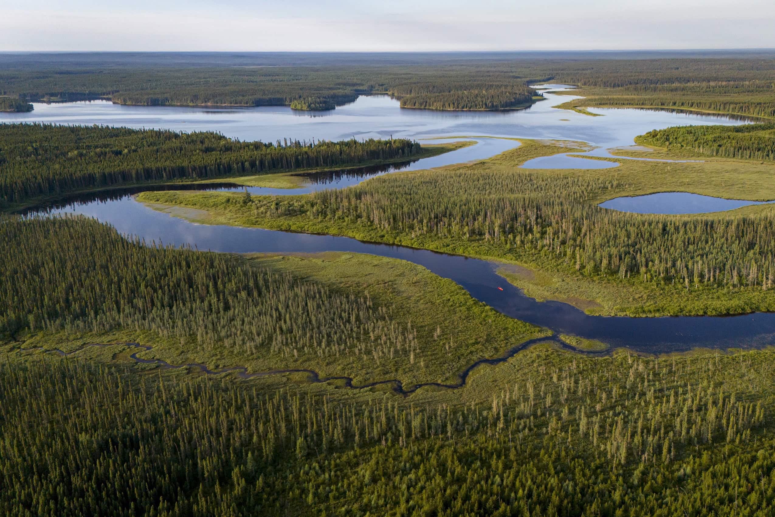
Their trip took them through a vast network of braided rivers and lakes, boreal forest and peatland. It also took them through the Ring of Fire, a mineral-rich region that Ontario’s government is keen to mine.
I have to ask about the cast iron. You don’t carry lightweight cookware on a trip like this?
We have one cast iron pan that has been on every trip the past nine years. We cook everything on fire (so long as we legally and safely can) and a cast iron doesn’t break down or flake off, and we can bake our bannock in it, fry fish, etc. So for us, it’s a failsafe solution that works year after year, which is worth its weight!
At what point on the trip did you first realize your course might be changing — that paddling back south to your truck wouldn’t be an option?
Along the way, we communicate via InReach, a two-way GPS texting device, to let friends and family know we are okay, and it gives them our exact location each night. As we left Wunnumin Lake, a friend texted saying it hadn’t really rained in two months. A few days later, he said Armstrong, near where he lives, was going to burn and that they were evacuated. Then he went silent. In Nibinamik First Nation, we learned his house burned, Collins was gone, and Armstrong was still okay.
We then discussed paddling the Winisk River, which we were presently on, to Peawanuck and Hudson Bay, but we knew we would encounter polar bears as it’s a major highway for them, flowing into Polar Bear Provincial Park. By the time we reached Neskantaga and had left the Winisk watershed, the Albany River was a wall of fire blocking us from going farther south, and we knew that even if it wasn’t, travelling to Armstrong would be too dangerous, so we turned down the Attawapiskat River to James Bay.
What were you thinking about as you heard of these destructive wildfires down south and close to home?
We felt awful and lucky at the same time. The fires’ devastation was affecting everyone we knew in some way that was so much worse than us. The smoke to the south of the fires was terrible, Thunder Bay and surrounding areas were in darkness from the heavy smoke and it was snowing ash. Leah’s family was on evacuation notice from a massive fire burning a little north of them, and all the while we just kept paddling with rainy days or blue skies. It was truly surreal.
You managed to speak with so many people along the way — had you been to most of these places before, to have some familiarity, or were people really just that friendly?
I’ve been lucky to visit all these communities except Webequie on prior trips, while either working on stories or travelling by canoe. In Nibinamik, a man named Hezekiah approached me and said “David?” with a smile. He’s a great traveller and knew about us from past journeys. That evening he brought us a gift bag with tea, oatmeal, honey and other snacks then shared stories about his homelands, areas we should paddle through sometime and tales of his epic travel that inspire us.
People in the north look after you while on their land and in turn we share stories with them about our experiences along the way. I learned about these canoeing routes from speaking with people in the north, hearing where their families travelled, the lakes they grew up on, and slowly this knowledge of a land braided by ancestral trails led to long summer travels in their homelands.
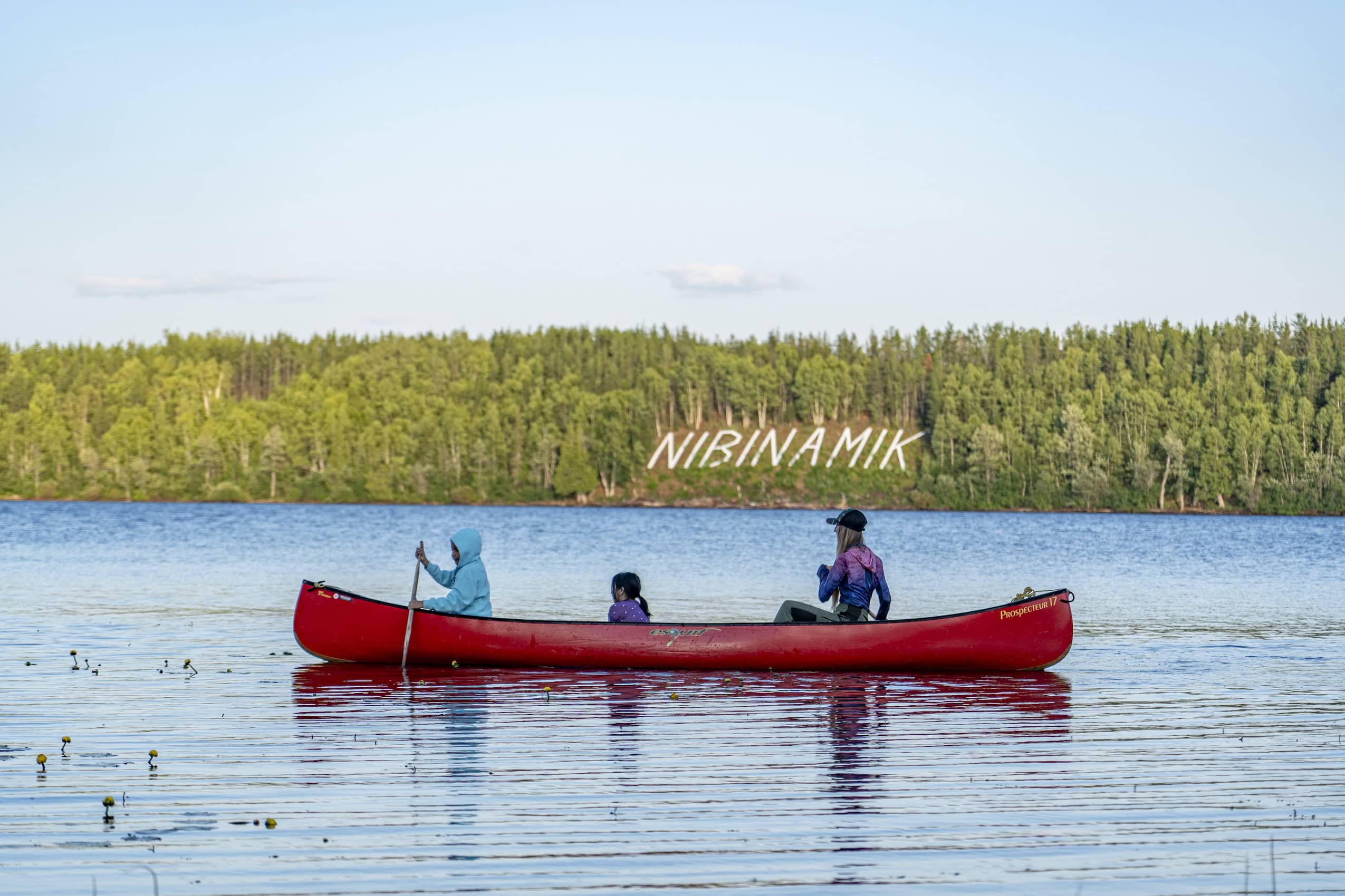
David and Leah had travelled to most of the First Nations along their route on prior trips. “People in the north look after you while on their land,” David says.
What kind of response did you get from people when they realized you’d arrived by canoe rather than plane?
A worker at Springpole mine asked where we had come from, to which we responded Sioux Lookout, and he demanded to know who dropped us off, what air service. When he realized we had canoed, his energy changed, he brightened up and we explained our route, the highlights and tough spots, and where we were ultimately going. The crew offered us snacks and showers, made sure we were okay, and sent us with well wishes on our way.
When people learn we’ve come from the land, the dialogue always shifts to water levels and wind, rains and fire, trails and rapids, camping places and cabins, animals and fish. Airplanes are a great convenience, but travelling by canoe, snowshoe, small boat or snowmachine is an intimate experience on a vast landscape and people respect that, a barrier is broken down, and good conversations flow easily.
What was a standout moment or highlight of this 55-day trip?
Sometimes there’s more than one memory: Leah and I often reflect on long journeys as a time in life when we were truly living in the moment. Every day, we pay close attention to every little detail, the shift of light, the stories on the land, the flow of water, the clues left by animals, the trails left by people, and in turn we see that we are always exactly where we are supposed to be.
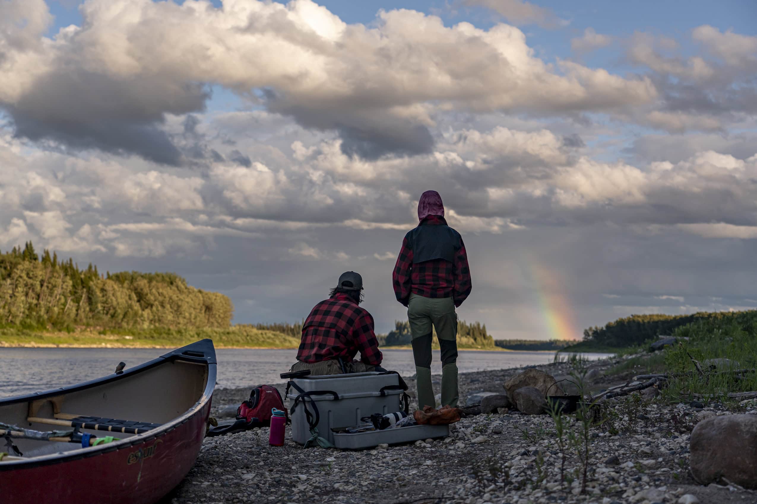
David and Leah’s canoe trip was a chance for them live in the moment and “reset [their] minds to the rhythm of serendipity.” Here, they watch as a rainbow appears above their campsite along the Attawapiskat River.
It can be easy to feel like life is overwhelming, or like we are one step behind, but on the land we reset our minds to the rhythm of serendipity, we believe that everything is happening for a reason, and in turn we are shown things that keep us looking.
Anything else you want to share about the trip, what you saw and reported?
To all the people whose homelands we pass through, and live on, thank you for sharing your ways of life. Leah and I travel not in our homelands, but through kindness and stories, we’ve been so lucky to feel at home while on the land.
The Narwhal’s reporters are telling environment stories you won’t read about anywhere else. Stay in the loop by signing up for our free weekly dose of independent journalism.
From The Narwhal | News on Climate Change, Environmental Issues in Canada via This RSS Feed.