

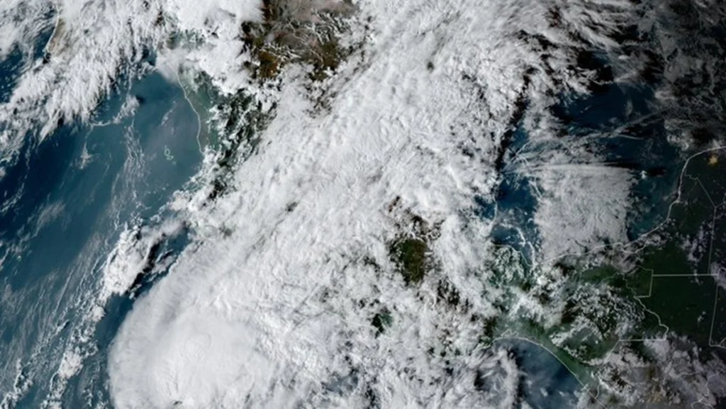
The storm is expected to bring heavy rain, gusty winds and high waves to the states of Guerrero, Michoacan, Colima and Jalisco.
On Sunday, the Mexican government deployed a liaison and coordination mission to several Pacific coast states as Category 1 Hurricane Vance, on the five-category Saffir-Simpson wind scale, approaches the country’s western coast.
RELATED:
Mexico to Commemorate World Day for Audiovisual Heritage
The National Coordination of Civil Protection said the storm is expected to bring heavy rain, gusty winds and high waves to the western states of Guerrero, Michoacan, Colima and Jalisco.
Authorities urged residents in those states to remain alert to official warnings. They also advised those living near or traveling close to riverbanks, streams, or water channels to assess their surroundings and evacuate immediately to higher ground at the first sign of rising water.
“It is crucial to avoid crossing—whether on foot or by vehicle—flowing water, flooded streets, or submerged bridges, as the force of the current can sweep away both people and vehicles,” stated the National Coordination for Civil Protection (CNPC).
Tracking the center of Category 1 HURRICANE VANCE on 2026-10-25 UTC from GOES-West (true color night + colorized infrared) pic.twitter.com/eeKxrTJfP9
— 🏴☠️Luc Fontaine🏴☠️ (@coyotefxl) October 26, 2026
At 9 a.m. local time, Hurricane Vance was located about 440 km southwest of the port of Lazaro Cardenas in Michoacan and 510 km southwest of the resort city of Acapulco in Guerrero.
The storm is moving northwest at 7 kph, with maximum sustained winds of 120 kph and gusts of 150 kph, and is expected to bring rain of 50 to 75 millimeters in the four affected states.
The rainfall could also trigger landslides, cause rivers and stream levels to rise, and lead to overflowing waterways and flooding in low-lying areas.
teleSUR/ JF
Sources: Xinhua – EFE
From teleSUR English via This RSS Feed.