

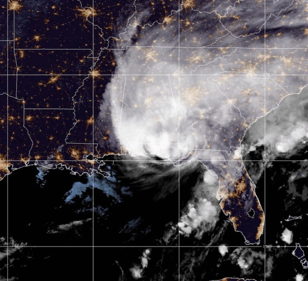
Hurricane Isaias made landfall in Florida as a Category 2 storm, while Hurricane Simon threatened Mexico’s Pacific coast with torrential rain and winds forecast to reach 230 kph.
Hurricane Isaias made landfall near Destin, Florida, on Friday night, leaving more than 530,000 electricity customers without power across Florida and Alabama, while Hurricane Simon strengthened in the eastern Pacific toward a forecast Category 4 storm threatening Mexico’s western coast.
RELATED: Hurricane Isaias Reaches Category 3, Threatens Florida Panhandle
Isaias came ashore at around 8:30 p.m. local time on Oct. 9 with maximum sustained winds of 165 kilometers per hour, according to the U.S. National Hurricane Center (NHC). Doppler radar data from the National Weather Service confirmed the storm’s landfall after it crossed the Gulf of Mexico.
The hurricane was located about 64 kilometers east of Pensacola and 80 kilometers west-northwest of Panama City. Although it weakened slightly in the hours before reaching land, it continued to pose serious risks from powerful winds and potentially life-threatening storm surge.
Power outages spread across the affected region, with impacts extending from southeastern Louisiana through Mississippi and Alabama to the western Florida Panhandle.
The Federal Emergency Management Agency (FEMA) approved an emergency declaration for Alabama on Friday night, authorizing federal funding and support for emergency protective measures. Florida had also requested an emergency declaration, but FEMA had not confirmed its approval in the information provided.
Meanwhile, Hurricane Simon was intensifying over the Pacific as it moved toward Mexico’s western coastline. The NHC reported that the storm had reached Category 2 strength, with forecasts indicating it could become a major hurricane by late Friday and continue strengthening on Saturday.
Fabián Vázquez, coordinator of Mexico’s National Meteorological Service, forecast that Simon would reach Category 3 on Friday and Category 4 on Saturday, bringing exceptionally heavy rainfall to the states of Jalisco and Colima.
The storm was expected to generate sustained winds of 230 kilometers per hour, with gusts reaching 280 kph at peak intensity. Vázquez said the system could maintain that strength through Saturday before reaching the coast of Jalisco on Sunday morning.
“During this period, it would maintain that intensity at least through Saturday. On Sunday morning, it would make landfall on the coast of Jalisco, with winds of 215 kilometers per hour and gusts of 260 kilometers per hour,” Vázquez said.
Rainfall forecasts pointed to accumulations exceeding 350 millimeters over the weekend in Guerrero, along the Michoacán coast, throughout Colima and along the Jalisco coastline.
For Saturday alone, more than 250 millimeters of rain could fall in Jalisco and Colima within 24 hours. Torrential rainfall was also forecast for Michoacán, with heavy precipitation expected in parts of Nayarit.
The outlook for Sunday maintained warnings of extraordinary rainfall exceeding 250 millimeters along the coasts of Jalisco and Colima, alongside heavy rain along the Nayarit coast and very heavy precipitation in Sinaloa.
Authorities urged residents in the areas threatened by Simon to remain alert as the storm strengthened and forecasts pointed to extreme rainfall and potentially destructive winds. The two hurricanes brought separate weather emergencies to the U.S. Gulf Coast and Mexico’s Pacific coast.
From teleSUR English via This RSS Feed.