

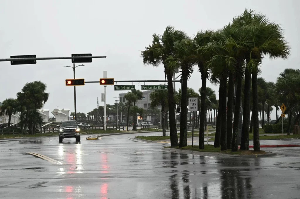
Hurricane Isaias intensified to Category 3 in the Gulf of Mexico on Friday with maximum sustained winds of 193 kilometers per hour, threatening Florida’s Panhandle with landfall expected between Friday night and Saturday morning.
Hurricane Isaias reached Category 3 strength on the morning of October 9, after a burst of rapid intensification that lifted its maximum sustained winds to 193 kilometers per hour.
It was moving north-northeast at 24 kilometers per hour, a track carrying it directly toward the Panhandle coast of Florida in the southern United States.
RELATED: Atlantic Records First Hurricane-Free September in 30 Years
The U.S. National Hurricane Center (NHC) warned that the system will come ashore between Friday night and Saturday morning as a highly dangerous hurricane. Meteorologists placed the center of the cyclone about 380 kilometers south of Pensacola and 273 kilometers from the mouth of the Mississippi River, a position that leaves little margin for further preparations along the coast.
10/09/2026 1p CT update: Hurricane #Isaias is beginning to bring tropical storm conditions to the northern Gulf Coast.
Isaias is a category 3 hurricane with max sustained winds near 120 mph. Fluctuations in intensity are possible through this afternoon, but Isaias is expected… pic.twitter.com/Hge2cmdVnG
— National Weather Service (@NWS) October 9, 2026
Specialists explained that the interaction of the storm’s wind field will generate severe impacts well beyond the exact point of landfall. With that threat in view, the agency maintains hurricane warnings from the Bay-Gulf county line in Florida to Ocean Springs in Mississippi, a corridor spanning hundreds of kilometers of shoreline.
The intensity arrived late in the season and drew attention for that reason. Conditions in the Gulf, however, turned favorable at the worst moment. Warm waters and reduced shear allowed the system to intensify rapidly in recent hours, transforming what had been a weaker storm into a major hurricane before it reached the coast.
BREAKING: Isaias is now a Category 3 hurricane, the first of the 2026 Atlantic hurricane season and the first in the Atlantic Basin since Hurricane Melissa last October. READ MORE: https://t.co/ynIBWnCvOM pic.twitter.com/5rcCJ7wUgM
— The Weather Channel (@weatherchannel) October 9, 2026
Evacuations and Warnings
Florida Governor Ron DeSantis expanded the state of emergency to 27 counties in the northern part of the state, a move meant to coordinate the institutional response across jurisdictions. Florida National Guard mobilized 5,000 personnel trained for emergencies, rescues and logistics operations in the zones under threat.
Local authorities began mandatory evacuations in several communities and asked residents to keep main roads clear so that rescue agencies could deploy without obstruction. Officials urged the public to remain sheltered and to comply strictly with the evacuation orders issued by local bodies.
The NHC estimated rainfall accumulations of 4 to 8 inches, between 100 and 200 millimeters, with isolated maximums of up to 15 inches, about 380 millimeters, across the Panhandle and Big Bend regions. Meteorological projections also indicate that the storm surge will reach heights of 4 to 7 feet, up to 2 meters, at vulnerable points such as Indian Pass and Yankeetown.
Hurricane #Isaias Advisory 13 (4 PM CDT, Fri Oct 9): Conditions Deteriorating Quickly Within the Storm Surge and Hurricane Warning Areas. Residents Should Be Seeking Safe Shelter. https://t.co/GrztW6mQJV
— National Hurricane Center (@NHC_Atlantic) October 9, 2026
Specialists warned that the water will cause flash flooding and severe erosion along the coastal strips of the territory. The combination of torrential rain and a rising surge presents the most serious danger to life and property, particularly in low-lying communities that sit close to the shoreline.
In the alert zones of Alabama, Mississippi and Louisiana, residents stocked their homes with basic supplies and fuel to ride out the expected power cuts. Transportation services suffered heavy disruptions, including the early cancellation of 140 commercial flights at terminals across the area.
The window to prepare is closing fast. With landfall expected between Friday night and Saturday morning, the hours ahead will determine how well the region withstands a storm that arrived late, strengthened quickly and now threatens millions along the Gulf coast.
From teleSUR English via This RSS Feed.