


Hurricane Isaias intensified into a Category 2 storm on Thursday, packing maximum sustained winds of 155 kilometers per hour as it pushed toward the southern U.S., where forecasters warn it could make landfall between Alabama and Florida late Friday or early Saturday.
The U.S. National Hurricane Center (NHC) reported in its latest advisory that Isaias was positioned 345 kilometers north of Progreso, Mexico, and 525 kilometers south of the mouth of the Mississippi River.
The storm was tracking northeast at 19 kilometers per hour, and its sustained winds of 155 kilometers per hour, roughly 96 miles per hour, pushed it firmly into Category 2 territory. It is the first official hurricane of the current Atlantic season, a milestone that underscores how unusually quiet the basin had been until this week.
RELATED: Atlantic Records First Hurricane-Free September in 30 Years
Forecasters expect the cyclone to strengthen further through the early hours of Friday. After that window, the NHC said, Isaias should hold as a highly dangerous hurricane as it closes in on the northern Gulf Coast through Friday night.
BREAKING: Hurricane Isaias is now a Category 2 storm and is expected to make landfall along the Gulf Coast Friday night, bringing life-threatening storm surge, damaging winds and flooding rainfall. READ MORE: https://t.co/GYLdmmCIef pic.twitter.com/l1aqJtXV4g
— The Weather Channel (@weatherchannel) October 9, 2026
Forecast Track and Timing
Current models place the landfall zone between Alabama and Florida, with arrival expected during Friday night or the predawn hours of Saturday. The center warned of “damaging winds” that would sweep across both states as well as Mississippi and Georgia, extending the storm’s reach far beyond the immediate coastline.
The system is also projected to dump heavy rain along the central Gulf Coast and across much of the Southeast from Friday through the entire weekend. The NHC cautioned that the rainfall could trigger flash flooding and significant urban flooding, while swollen rivers could threaten parts of North Carolina and South Carolina as the water moves inland.
Hurricane Isaias is headed for a Gulf Coast landfall Friday night with life-threatening storm surge, rainfall flooding and high winds. It will then spread its heavy rain and wind inland over the Southeast this weekend. It’s expected to strengthen to at least a Category 2… pic.twitter.com/ffTHtMCmvB
— The Weather Channel (@weatherchannel) October 8, 2026
States Mobilize Resources
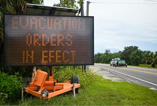
Florida Governor Ron DeSantis ordered the preventive deployment of more than 12,000 personnel, including 5,000 National Guard troops, ahead of a potential landfall as a Category 2 or 3 storm. He declared a state of emergency across 25 counties and issued mandatory evacuation orders for the Panhandle, the northwestern stretch of the state projected to absorb the hardest blow.
Alabama Governor Kay Ivey declared an emergency for 40 counties, matching the urgency across the state line. The coordinated response follows weeks of calm in an Atlantic season that had been recording a historic low in activity, a lull that forecasters attributed to El Niño phenomenon conditions.
The climate pattern produces warmer-than-usual waters and fuels a greater number of Pacific cyclones while suppressing the formation of Atlantic storms. Isaias has broken that spell, and communities across four states now face the season’s first major test.
Officials urged residents in the projected impact zone to finish their preparations while conditions still allowed. Emergency managers stressed that the track could still shift and that areas outside the forecast cone should remain alert to flash flooding, downed trees and prolonged power outages through the weekend.
For now, the exact landfall point and the storm’s final intensity remain open questions. What is certain, forecasters said, is that the Gulf Coast will face dangerous winds and heavy rain within the next 48 hours.
From teleSUR English via This RSS Feed.