

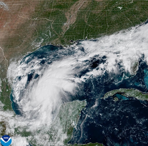
MIAMI (AP) — Tropical Storm Isaias formed Wednesday in the warm waters off eastern Mexico and forecasters said it was expected to strengthen into the first hurricane of the Atlantic season before hitting the U.S. Gulf Coast later in the week. The rapidly strengthening storm was on track to tie or break a 121-year-old record as the latest arriving initial hurricane of the Atlantic season. According to the National Weather Service, the record dates to 1905, when the year’s first Atlantic hurricane formed on Oct. 8. The Miami-based National Hurricane Center on Wednesday issued a hurricane watch for the northern Gulf Coast from Bay St. Louis, Mississippi, to Indian Pass on the Florida Panhandle. The watch means hurricane conditions are possible within 48 hours. Isaias was centered about 260 miles (420 kilometers) northwest of Progreso, Mexico, and about 540 miles (870 kilometers) southwest of the Mississippi River’s mouth, according to the National Hurricane Center. It had maximum sustained winds of 45 mph (75 kph) and was moving east-northeast at 8 mph (13 kph). Forecasters predict Isaias will become a hurricane by Thursday as it turns northward toward the U.S. Gulf Coast. Though its path and timing could shift, the storm is expected to make landfall late Friday or early Saturday. The hurricane center said residents of the northern Gulf Coast should prepare for dangerous wind, storm surge and heavy rain that could trigger flash floods. “It’s definitely time to look at your hurricane plan and put whatever you need into…This article was originally published on Mongabay
From Conservation news via This RSS Feed.
It’s not that bad looking right now: