

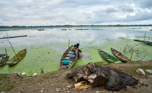
For generations, Kashmir’s wetlands, lakes and rivers have been woven into the landscape around its towns and villages. Paddy fields once stretched across parts of the valley, while canals and springs were familiar features of everyday life. But much of that landscape has changed. A new study published in Water Science assessing six decades of land use and land cover change in the union territory of Jammu and Kashmir in the northernmost part of India finds that the extent of water bodies declined between 1960 and 2020, while built-up areas expanded markedly, particularly after the 1990s. The researchers found that socioeconomic factors including urbanization, population growth, literacy, per capita income and passenger and freight traffic were more strongly associated with many of these changes than the climatic variables they examined, including annual precipitation and mean maximum and minimum temperatures. The findings raise a broader question for Jammu and Kashmir: As development continues to reshape the landscape, are conservation initiatives and land use planning keeping pace with the pressures on the region’s water bodies? The authors caution that the study is not based on primary field surveys. Because land use records were available mainly at decadal intervals, the researchers interpolated data between those years to create an annual data set for their statistical analysis. They acknowledge that this approach can inflate some statistical measures and say the results should be interpreted primarily as associations rather than precise predictions. Still, the broad direction of change is clear. The sun peeks through a…This article was originally published on Mongabay
From Conservation news via This RSS Feed.