
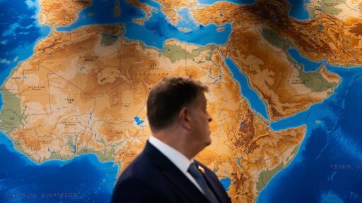

The United Nations General Assembly has backed an African-led initiative calling for a more accurate representation of the world’s continents, particularly Africa, in maps used in education, public communication, and other areas.
On September 4, the General Assembly adopted the resolution titled “Correct the Map: Rebalancing Global Cartographic Representation and Promoting Equitable Representation of the World’s Regions, Particularly Africa.” The resolution was sponsored by Togo on behalf of the African Group and passed by an overwhelming 164 votes to one, with six countries, Estonia, Georgia, Lithuania, Moldova, Serbia, and Ukraine, abstaining. The United States was the only country to vote against it. Speaking before the vote, Yaryna Ferencevych, deputy US representative to the UN Economic and Social Council, dismissed the initiative as an “ideological project” rather than a meaningful priority for the United Nations.
The vote represents an important moment in a campaign arguing that the maps through which generations have learned about the world have not always provided an accurate picture of the relative size of continents.
Introducing the resolution, Togo’s minister for foreign Affairs, Robert Dussey, argued that the issue was not simply about replacing one map with another. It was about looking at how humanity has been taught to see the world.
“Maps shape our understanding of the world,” Dussey told the General Assembly. “They guide education, nourish the imagination and influence collective perceptions.”
For the African states behind the initiative, the question was therefore not just technical. The way the world is represented, he argued, influences how people understand the relative importance, size and place of different regions and peoples.
What the resolution asks for
Beyond encouraging member states and international organizations to adopt more accurate cartographic representations, he pronounced that the purpose is strictly cartographic, scientific, and educational. “What we are doing here is promoting a more accurate representation of the relative sizes of the world’s regions. I would like to reassure everyone that what we are discussing is fundamentally a matter of science.”
Stressing that the text invites UN entities, regional organizations, academia, think tanks, and technology companies “to cooperate in order to build national capacities, support research and innovation,” with particular attention to developing countries and African countries in map-making, geography, and geospatial technology.
Adding that the resolution “fully respects existing mandates,” creates no new financial obligations, and does not establish any new institutional mechanism at the UN. Education is nonetheless central to it, the text encourages a more critical approach to how maps are taught in school curricula, including an explanation of projection methods, their characteristics, their limits, and their appropriate uses.
Why this matters for Africa
The debate centers largely on the widespread use of the Mercator projection, developed by Flemish cartographer Gerardus Mercator in 1569.
The Mercator projection was designed primarily for maritime navigation. Its ability to preserve directions made it particularly useful to sailors navigating long distances. But that advantage comes with significant distortions in the relative size of landmasses.
The further a territory is located from the Equator, the larger it appears on the map. Greenland, for example, can appear roughly comparable in size to Africa, even though Africa is around 14 times larger. Africa covers approximately 30.4 million square kilometers and is the world’s second-largest continent.
The result is a world map in which countries and regions in northern latitudes appear disproportionately large, while Africa and other areas closer to the Equator appear relatively diminished.
Togo’s foreign minister tied the resolution directly to several ongoing African-led initiatives: the Decade for African Roots and the African Diaspora (2021–2031), the Second International Decade for People of African Descent (2025–2034), and the final declaration of the Ninth Pan-African Congress. Correcting “disproportionate cartographic representations” of the continent, he said, is part of ensuring Africa is “appropriately recognized on the international sphere” and of “restoring the dignity of the continent and its diasporas” by correcting “historic distortions that we have inherited from our past legacies.”
Adding, “By adopting this resolution, we’re not just correcting a map, we are contributing to correcting our perception,” he said, adding that knowledge “should elevate,” should “bring us closer, not divide us,” and should reflect the world “in all of its diversity, its truth, and its dignity.”
He rejected the idea that this was a symbolic gesture, “Correcting the map is not simply an aesthetic or symbolic issue, but rather, it is a demand for scientific accuracy and educational accuracy.” Each region, he argued, matters and each people “deserves to be seen as they are” with Africa, “like all other regions,” belonging in humanity’s “universal consciousness,” recognized “in its full reality, its contributions, and its future” rather than “diminished by distortions from the past.”
The overwhelming support for the resolution has been met with broad and positive reception across Africa and in many parts of the world.
From BT News via This RSS Feed.