

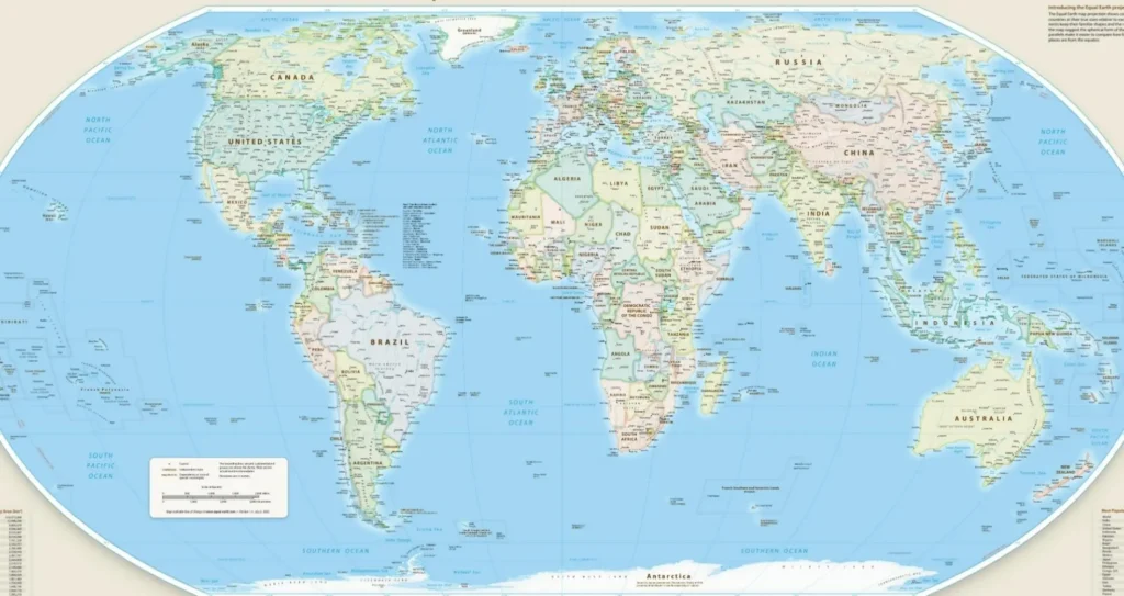
The United Nations General Assembly has approved a resolution promoting the progressive replacement of the traditional Mercator projection with equal-area models such as Equal Earth, following a campaign led by African countries to end long-standing distortions in global maps.
The measure received 164 votes in favor, with six abstentions — Estonia, Georgia, Lithuania, Moldova, Serbia and Ukraine — and one vote against, cast by the United States. It was introduced by Togo on behalf of the African group and endorsed by the African Union.
RELATED: 3 Urgent Reforms Needed for African Union Peace Architecture
The Mercator projection, devised in 1569 by Flemish cartographer Gerardus Mercator, was created to aid maritime navigation but expands landmasses progressively farther from the equator. As a result, Greenland appears similar in size to Africa even though Africa is about 14 times larger and exceeds the combined area of the United States, China, India and Western Europe.
The resolution argues that the visual bias contributed to the symbolic minimization of Africa and perpetuated a Eurocentric view of the planet. The African Union described the initiative, called “Correct the Map,” as an act of cognitive justice and memory repair aimed at reversing what it termed cartographic colonialism.
Togo’s Foreign Minister Robert Dussey said maps guide education and influence collective perceptions, adding that a “fair map does not change the geography of the world; it changes the way we see the world.”
CORRECT THE MAP IS NOT THEREFORE ABOUT ATTACKING A MAP, IT IS ABOUT CORRECTION A DISTORTION. @_AfricanUnion #FairWorldFairMap #TrueSizeOfAfrica #CorrectTheMap #MapsMatter #CartographicJustice #RepresentationMatters #AfricaMatters #DecolonizeMaps #KnowAfrica #GlobalJustice… pic.twitter.com/Z1i9IChLOz
— Robert Dussey (@rdussey) September 2, 2026
The adopted text does not prohibit Mercator or impose a single model, but urges governments, educational institutions, agencies such as UNESCO, and technology companies to use equal-area designs when the relative size of landmasses is relevant.
French Foreign Minister Jean-Noël Barrot announced that France plans to abandon the Mercator projection in official cartography, aligning with the African proposal. On the other hand, the U.S. delegation rejected the measure as a much broader and more radical ideological project, saying it mocks the work and purpose of this institution.
Ukraine and the European Union expressed reservations about applying Equal Earth on web platforms regarding international borders and disputed territories. Ireland, speaking for the EU, clarified that support concerns only landmass proportionality and does not affect sovereignty, territorial status or recognized borders.
From Addis Ababa, the African Union celebrated the vote as a historic milestone, stressing that how geography is depicted directly influences perceptions of the political, demographic and geopolitical weight of the Global South.
From teleSUR English via This RSS Feed.