

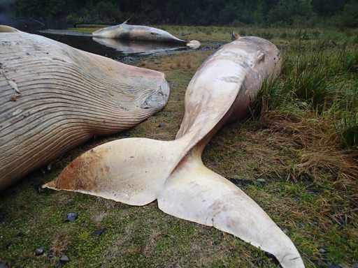
In 2015, the remote coastal fjords of southern Patagonia turned into a whale graveyard. That June, scientists found 337 dead and decomposing sei whales, a species of baleen whale, on the beaches between the Gulf of Penas and Puerto Natales in Chile. Researchers flew over the area, then took samples from the rotting bodies, trying to find clues as to why this happened. It was later reported to be the largest mass baleen whale mortality event on record. Data collected to determine the cause proved inconclusive, however. Scientists thought the most likely explanation was a toxic red tide provoked by pollution, a strong El Niño event and climate change. What researchers now know for certain, after using very high-resolution satellite images, is that the stranding occurred at least two months before the whales were found. “It’s quite shocking, really,” Penny Clarke, a whale scientist at the British Antarctic Survey (BAS), told Mongabay in a video call. “Think that these whales are about the size of a bus, and there’s 300 … of them, and nobody knew about it for about two months.” The massive stranding in Chile had one bright spot: It offered an important opportunity to test the use of satellite technology to monitor strandings and support data collection on whale mortality. More than 10 years later, Clarke and her BAS colleagues not only use satellite imagery to identify different whale species by observing flippers and flukes in the water, but can spot whale strandings almost anywhere in the…This article was originally published on Mongabay
From Conservation news via This RSS Feed.