

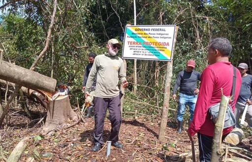
Agents of Brazil’s Indigenous agency, FUNAI, spent 60 days in June and July 2026 physically marking the borders of the Rio Pardo Kawahiva Indigenous Territory. The 411,000-hectare (1 million-acre) area in the Amazon biome of Mato Grosso state is home to the Kawahiva, an isolated Indigenous group. The government agency confirmed the presence of the Indigenous group in 1999 and began demarcating its territory in 2001. “The uncontacted Kawahiva have been under threat in their own forest home for decades, while simply trying to exercise their right to live as they choose without contact,” Caroline Pearce, director of the UK-based NGO Survival International, said in a statement. Still image of a Kawahiva individual taken by federal agents in August 2013. Image courtesy of FUNAI. The territory has been invaded by land-grabbers and loggers, causing deforestation. Historically, the Kawahiva territory was intermittently protected via temporary land protection orders, which faced opposition from logging companies. To officially demarcate the territory, FUNAI agents opened a path around the land and installed roughly 140 signs at strategic locations, FUNAI agents told Mongabay. “Here in our region, all owners of plots of land do this,” Jair Candor, coordinator of the FUNAI unit that safeguards the Kawahiva, told Mongabay in an audio message. “The limits of land are marked by opening a path around that territory, whether it belongs to the white man or to an Indigenous person.” The last of more than 100 signs was placed on July 3, 2026. Image courtesy of Kenedy…This article was originally published on Mongabay
From Conservation news via This RSS Feed.