

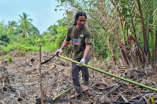
SUNGAI APIT, Indonesia — Harisyah was still knee-deep in peat as the light faded over the mouth of Indonesia’s Siak River. The 53-year-old palm oil and pineapple grower had been cutting back weeds since morning, clearing the riverbank on the north coast of Sumatra island before driving wooden stakes into the peat at 1.5-meter (5-feet) intervals. “We’re going to use this location as a nursery for the new seedlings,” Harisyah told Mongabay Indonesia. “This new generation will grow up close to mangroves, and they can learn more about them through playing and activities.” Harisyah and others who live in Tanjung Kuras, a coastal village in Siak district, say the weather has become increasingly erratic in recent years. Researchers, meanwhile, have documented a rapidly retreating coastline as the area’s peat soils continue to subside. Residents also contend with frequent tidal flooding, which many blame on the loss of the mangrove forests that once fortified the shoreline. Last Ramadan, the Islamic holy month observed by millions in the world’s largest Muslim-majority nation, strong winds lifted off the dome from the village mosque. “It’s because there’s no mangrove forest as a buffer to block the wind,” Harisyah said. “It’s been turned into an oil palm plantation — so the wind from the sea blows straight onto land.” Harisyah plants a marker stake at the mangrove planting site. Image by Suryadi/Mongabay Indonesia. World’s largest mangroves Indonesia’s more than 17,000 islands contain the world’s largest mangrove forest estate, covering about 3.3 million hectares (8.2 million…This article was originally published on Mongabay
From Conservation news via This RSS Feed.