


Bullets:
Intelligence analysts note dramatic, and sudden, advances in Iranian missile and drone capabilities.
Inside China / Business is a reader-supported publication. To receive new posts and support my work, consider becoming a free or paid subscriber.
During last year’s war on Iran, IDF and American forces successfully “spoofed” Iranian drones and missiles, which relied on GPS navigation systems.
But after that conflict, Iran switched to Beidou, a Chinese satnav system that cannot be jammed by Western militaries.
Beidou is also more accurate than GPS in most of the world, including in the Persian Gulf region.
Iranian drones and missiles are now threading through air defenses, and taking down critical, high-value targets across the Gulf States, who also rely on GPS.
Ironically, China’s motivation to build the Beidou system began over thirty years ago, when the Pentagon switched off GPS to a Chinese container ship bound for Iran.
By 2020, Beidou leapt past GPS in coverage and accuracy in most of the world.
Report:
Good morning.

This all started over 30 years ago. This is the Yinhe, a Chinese container ship. It was enroute to Iran, when the Central Intelligence Agency claimed that the ship was carrying material to build chemical weapons. The United States told Middle Eastern countries to refuse entry to the Yinhe, and they agreed. The ship was stranded in the Indian Ocean for weeks, while the US demanded the ship return to China.
Chinese authorities inspected the ship, and found no evidence of what the CIA said was aboard. American military aircraft and ships were dispatched, and the US “disabled the Chinese vessel’s access to GPS”. That caused the Yinhe to lose navigation, and forced them to drop anchor, where it sat for over 3 weeks.
Negotiators agreed to let the ship dock in Saudi Arabia, where representatives from the United States, China, and Saudi inspected the vessel, and certified that no hazardous cargo was on board.
China demanded compensation for economic losses, and American officials said no to that, and even refused to apologize, saying that even though the intelligence was bad, that the US had “acted in good faith”.

Those events, transpiring over the course of a month or so, impelled China to develop its own satellite navigation system. At the time, GPS was a monopoly, and the world just learned that the United States could switch it off and strand ships mid-ocean. Chinese media even today point to the Yinhe incident as their motivation for developing their system, called Beidou.
Beidou System 1 was completed in 2002, and -2 was rolled out in 2012. In 2020, BDS-3 was launched, and today China’s Beidou is more accurate than GPS in many areas of the world. The map below preceded the introduction of BDS-3, and since then Beidou’s coverage has only grown:
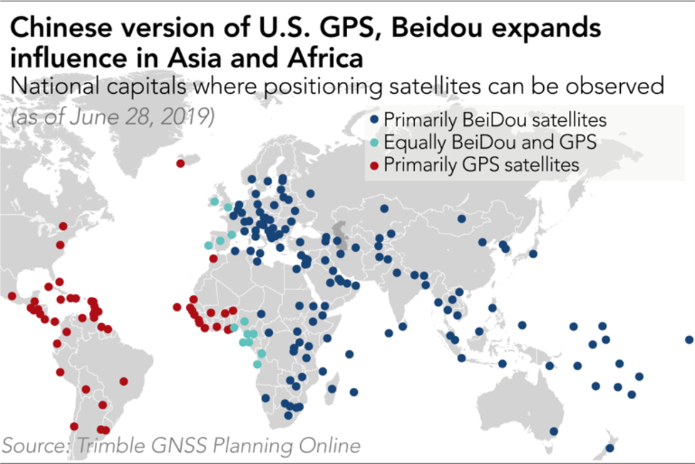
The Chinese system now uses 56 satellites; many more than GPS. Beidou also deployed over ten times as many monitoring and ground stations across the world, especially in the Global Majority Countries, which dramatically improves the accuracy of Beidou compared to GPS in those areas of the world. So with the deployment of BDS-3 in 2020, Beidou had superior coverage over GPS in 165 countries. Said another way, GPS outperforms Beidou in just 30 countries.

So in countries outside North America and Western Europe, Beidou is more precise, and presents an alternative that cannot be turned off by the Pentagon. And we see again how the Yinhe Incident is used by proponents of the Beidou system to sell it. The United States jammed the navigation system of a civilian container ship, which had to drop anchor in the middle of the ocean and wait for the US Navy to tell it where to go. Every country that relies on GPS for their navigation is vulnerable.
That vulnerability is what drove China to build Beidou, and it’s what drove Iran to ditch their GPS for Beidou after the war last year. During the 12-day war last summer between Iran and Israel and the US, the Israeli military was successful in jamming Iranian navigation systems, and so after the conflict Iran went shopping for alternatives:
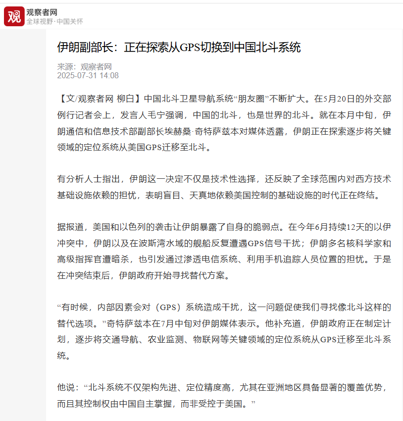
By the time this round began, in late February of 2026, Iran had dumped GPS and moved over to Beidou. These reports are from March—the early days of the conflict, and already it was apparent to intelligence services that the switch to Beidou marked a big upgrade in Iranian capabilities. The Israeli electronic warfare strategies that worked in 2025 suddenly did not anymore. The military-grade BDS-3 is “essentially unjammable”, and uses advanced and complex freq-hopping technology and messaging systems that prevent spoofing
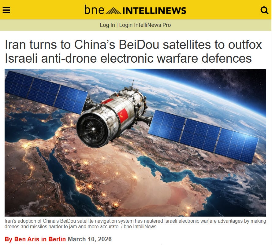
.So when Iranian drones were launched toward Israeli targets previously, the IDF could send false targeting data to the inbound munitions and steer them away. That was before. Now, the Beidou system filters out that interference, and the positioning success rate holds at 98%.
Those are anti-electronic warfare improvements; Electronic counter-countermeasures, which are on the defensive side. But intelligence analysts believed, early in this year’s conflict, that Iran had also dramatically improved the offensive performance of their missiles and drones.
Beidou-3’s electronic architecture is built to minimize interference, from all sources, and eliminate errors in real time, while in flight. The Circular Error Probability drops to under 5 meters for missiles using Beidou, and that allows for an entirely new combat doctrine. Fewer missiles can be launched to destroy the same number of targets.
The Beidou upgrade not only made Iranian missiles and drones unjammable, but the on-board messaging system allows for real-time adjustments by controllers, up to 2000 kilometers away. If they detect an air defense unit, or a Patriot missile battery, or an enemy aircraft, commanders can simply transmit new flight instructions.
By combining Chinese satellite intelligence with Iranian kinetic weapons, Teheran built an intelligent kill chain that is completely outside Western technology.
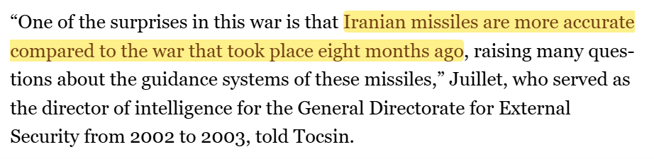
The latest War on Iran kicked off on 28 February, and just two weeks later it was obvious to intelligence officials that everything was different, this time. This report is from 11 March, and Iranian missiles were much more accurate compared to just eight months prior. The US government can jam anyone on the GPS platforms, which it owns.
But that monopoly is gone, and Beidou users cannot be jammed. Beidou uses more satellites and ground stations than any other satellite navigation system, and so theoretically should be more accurate, when used as an offensive tool, and more resilient, defensively.
That is no longer a hypothetical: In just the first days, Iran’s drones and missiles had blown through Pentagon and IDF air defenses and taken down significant, high-value targets. American allies across the Middle East – and the world – concluded that there is, no longer, an American security umbrella, if the [United States can no longer defend their own fleet headquarters](http://how/ Iran Devastated an American Naval Base—and Caused a U.S. Recalculation https://www.wsj.com/world/middle-east/iran-us-naval-base-bahrain-e87bbca3) and multi-billion-dollar radar stations.

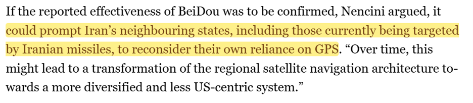
Iran’s access to Beidou is game changer, and it’s obvious to the other Gulf States that host American bases, and use GPS themselves.
And by sharing their satnav technology with Iran, the Chinese assess the effectiveness of its systems against the newest-generation weapons platforms deployed by the Pentagon, and can field-test new technologies and fighting doctrines on a real battlefield.
And this all began with bad intel from the CIA, and a Chinese container ship, heading for Iran. Thirty years ago.
Be good.
Resources and links:
“Breathing Fire” After Yinhe Embarrassment, China’s Pledge To Counter U.S. GPS Reaches Key Milestone
https://www.eurasiantimes.com/gps-an-embarrassment-like-the-yinhe-incident/
The GPS Blackout That Changed Everything for China
https://www.bastillepost.com/global/article/5927187-the-gps-blackout-that-changed-everything-for-china
Iran turns to China’s BeiDou satellites to outfox Israeli anti-drone electronic warfare defences
https://www.intellinews.com/iran-turns-to-china-s-beidou-satellites-to-outfox-israeli-anti-drone-electronic-warfare-defences-430349/
Could Iran be using China’s highly accurate BeiDou navigation system?
https://www.aljazeera.com/features/2026/3/11/could-iran-be-using-chinas-highly-accurate-beidou-navigation-system
China’s Push for Satellite Cooperation in the Middle East
https://www.washingtoninstitute.org/policy-analysis/chinas-push-satellite-cooperation-middle-east
In 165 countries, China’s Beidou eclipses American GPS
https://asia.nikkei.com/spotlight/century-of-data/in-165-countries-china-s-beidou-eclipses-american-gps
伊朗副部长:正在探索从GPS切换到中国北斗系统
https://m.guancha.cn/internation/2025/_07/_31/_784997.shtml
Gulf Countries Confront Questions About Relying on U.S. for Protection
https://www.nytimes.com/2026/06/15/world/middleeast/gulf-iran-war-us.html
Iran reportedly destroys $300M US missile defence radar in Jordan
https://www.trtworld.com/article/6ddaf3c21548
How Iran Devastated an American Naval Base—and Caused a U.S. Recalculation
https://www.wsj.com/world/middle-east/iran-us-naval-base-bahrain-e87bbca3
Inside China / Business is a reader-supported publication. To receive new posts and support my work, consider becoming a free or paid subscriber.
From Inside China / Business via This RSS Feed.