

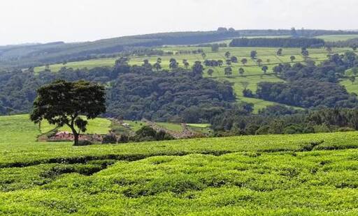
Laikipia County has dominated headlines in recent weeks, first over a secretly negotiated U.S. Ebola quarantine facility at Laikipia Air Base, protests, then two Kenyans shot dead on June 1, 2026, the same day Kenya marked 63 years since flag independence, a Kenyan court blocking the facility twice and US military planes flying in equipment anyway.
But in all the coverage of Laikipia, almost nobody has stopped to ask the most fundamental question about the area at the center of this storm. Who owns it and who owns so much of Kenya’s most fertile land? How did one of Africa’s most celebrated anti-colonial struggles end with so much of the colonial land structure still intact? The answer begins in a place the British called the White Highlands.
The White Highlands: How Kenya Was Designed for the British Elite
The story of modern land ownership in Kenya begins with a colonial project so ambitious that its architects hoped to turn parts of East Africa into a permanent white settler state. The cool climate reminded many of southern England. The high-altitude grasslands were ideal for cattle. The volcanic soils were among the most productive in Africa. But there was one problem. The land was already occupied. The Kikuyu, Maasai, Kalenjin and other communities had lived, farmed, grazed and traded across these regions for generations. Land ownership often operated through customary systems rather than individual title deeds. British officials ignored this reality. Following the establishment of the East Africa Protectorate in 1895, colonial authorities began identifying vast areas of fertile territory for European settlement. The arrival of the Uganda Railway accelerated the process. Through a series of ordinances and administrative decrees, millions of acres were declared Crown Land. In practice, this meant the British Crown claimed ownership over territory that African communities had occupied for centuries. Once the land became Crown property on paper, colonial authorities could lease or allocate it to settlers. The most desirable areas became known as the White Highlands. Europeans received large farms and ranches, and Africans were gradually pushed out. By the 1930s, a relatively small settler population controlled the lion’s share of Kenya’s most productive land. Approximately 7.5 million acres of prime arable land in the Rift Valley and Central Highlands were set aside for European agriculture. Among the most influential beneficiaries was Hugh Cholmondeley, the Third Baron Delamere. Widely described as the father of Kenya’s settler community, he acquired enormous tracts of land and became one of the loudest advocates for permanent European settlement. He argued that Kenya’s future depended on white farmers controlling its agricultural economy. The reason why Kenya’s land crisis looks different from Zimbabwe’s or South Africa’s is that the British intended Kenya to be a different kind of colony. At its peak, Kenya’s white settler population was only approximately 60,000 people. Zimbabwe, by contrast, had nearly 300,000 white settlers at its peak, owning over 15 million hectares of land. South Africa’s settler population ran into the millions. Kenya was different by design. The Colonial Office explicitly marketed the Kenya highlands to the British aristocracy, and the region gained international infamy as a playground for wealthy elites. It was less of a destination for the British working class and more of a playground for the ruling class. The result was a colony defined by the vast scale of what each settler took. The settler population was small, but the land grab was enormous. In Laikipia County alone, approximately 48 large-scale ranches account for over 40% of the total land area. The communities whose ancestors were removed at gunpoint to make way for those ranches live on the margins, literally and economically, of land their grandparents owned. One of the most significant confrontations involved the Maasai, whose struggle against dispossession would expose the gap between British promises and their actions
A Treaty Worth Nothing
The Maasai were the first to discover what British promises meant in practice.
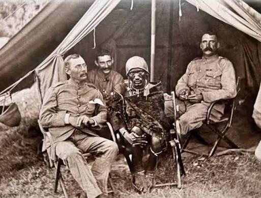
In August 1904, the British colonial administration signed a treaty with Maasai clan leaders that gave them the Laikipia plateau “for eternity,” a clause that explicitly barred any settler from taking up land in Maasai territory. Seven years later, in April 1911, Governor Edward Girouard convened Maasai clan leaders and obtained new signatures transferring the Laikipia land to European settlers, in direct contradiction of the 1904 promise. A subsequent legal challenge by Maasai leaders, the 1912 Ole Njogo case, was dismissed by colonial courts, which ruled that the original treaties were “acts of state” not subject to judicial review.
In 1915, the Crown Lands Ordinance formalised the injustice: European settlers received 999-year agricultural leases, leases that, in practical terms, were indistinguishable from outright ownership and were designed to outlast any conceivable political change, including independence itself.
It worked. Independence came in 1963, and nothing changed.
One of the families whose land was taken under this 1915 Ordinance was that of a young boy named Ngũgĩ, born in 1938 in Kamiriithu near Limuru in Central Kenya. His family’s farmland was repossessed under the same 1915 Imperial Land Act that created the great estates documented in this article. Decades later, Ngũgĩ wa Thiong’o would become one of Africa’s most celebrated writers, but the dispossession was similar to that of families across the highlands. His half-brother Mwangi was killed fighting as part of the Kenya Land and Freedom Army, the Mau Mau, during the uprising that followed a few decades later. His mother was tortured at a colonial home guard post. The land question formed a major anti-imperialist grounding for the man who would go on to write some of the defining literature of postcolonial Africa.
A Register of What Was Stolen
The scale of what remains in settler and foreign hands in Laikipia alone is staggering.
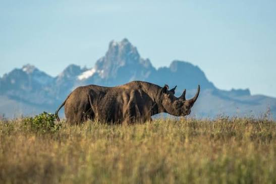 Ol Pejeta Conservancy: 90,000 acres. Originally cleared and established as a mega-scale beef ranch by British colonial settler Lord Delamere in the 1940s, Ol Pejeta is today globally celebrated as a conservation landmark, home to the last two northern white rhinos on earth. Its transformation from cattle ranch to conservation icon is a story the international media tells with admiration.
What that story tends to omit is the ownership history in between. After Delamere, Ol Pejeta passed through several hands, including Adnan Khashoggi, the Saudi arms dealer whose fortune connected African land to the shadowy world of Cold War finance, Western weapons companies and covert geopolitical deals.
Only in 2003 was the land placed in a conservation trust. The transformation into a conservation icon is real, and the wildlife work being done there matters. But the question of how 90,000 acres came to exist as a private estate in the first place, and what happened to the communities displaced to create it, has never been the subject of the same global attention as the rhinos that now live there.
Soysambu Conservancy: 48,000 acres. The Delamere estate, one of the most historically significant and politically charged landholdings in Kenya. Lord Hugh Cholmondeley, the 3rd Baron Delamere, founded Soysambu in 1906 after arriving in Kenya on foot following a thousand-mile walk from Somalia. His descendants retain the estate today; the family has farmed this land continuously for 120 years.
The Delamere name became internationally notorious in the 2000s when Tom Cholmondeley, great-grandson of the pioneering Lord Delamere, was involved in two fatal shootings of Kenyans on the Soysambu estate within roughly a year of each other. In 2005, he shot and killed Kenya Wildlife Service ranger Samson ole Sisina. In 2006, he shot and killed Robert Njoya, a stonemason he accused of trespassing and poaching. Cholmondeley was convicted of manslaughter in the Njoya case and served five months in prison. The estate continued operating throughout both cases, and continues to operate today. Cholmondeley himself died in 2016 and is buried at Soysambu, a short distance from the grave of the great-grandfather who founded the estate over a century earlier.
Lewa Wildlife Conservancy: 45,000 acres. Originally land awarded to the Craig family for their services during the First World War, a direct colonial-military land grant. The Craig family still operates the conservancy.
Borana Ranch: 32,000 acres. Bordering Lewa, under the stewardship of the Dyer family for generations. Originally a cattle ranch established in the early 20th century, now operating as a luxury photographic tourism and conservation destination.
Lolldaiga Hills: 49,000 acres. A cattle ranch and conservancy north of Mount Kenya, still tied to descendants of the British settlers who originally claimed it during the colonial era, and the site of one of the most significant legal confrontations between Kenyan communities and the British military in the country’s history.
Laikipia Nature Conservancy (Ol Ari Nyiro): 98,000 acres. Owned by Kuki Gallmann, the Italian-born author of I Dreamed of Africa, the international bestseller that introduced millions of readers to a romanticised vision of white settler life in Kenya, later adapted into a Hollywood film starring Kim Basinger. Gallmann and her husband Paolo acquired the ranch in the early 1970s, after independence, which makes its history somewhat distinct from the original colonial-era land grants documented elsewhere in this register, but the underlying pattern is similar. The land had already been cleared, fenced, and ranched by earlier European settlers before the Gallmanns bought it; ownership simply passed from one settler-descended family to another, never returning to the communities displaced to create it in the first place. The conservancy remains, by most measures, the single largest private landholding on the Laikipia Plateau.
Suyian Ranch: 43,495 acres. Owned and managed by the Powys family, English settlers whose presence in Laikipia dates to the 1920s, when Will Powys first grazed livestock on leased colonial land. Powys purchased the ranch outright in 1963, the same year Kenya gained independence, converting a colonial lease into permanent family ownership at the precise historical moment the colonial land system was supposed to end. Three generations later, the Powys family still manages the estate, now restructured as a conservation trust.
Mugie Conservancy: 46,000 acres. Established and still managed by the Hahn family, with roots in East African wildlife management spanning over four decades. Around half the ranch has been set aside as a dedicated wildlife sanctuary, home to the endangered Grévy’s zebra and a significant population of lions and African wild dogs.
Within Laikipia’s plateau, more than a dozen large private conservancies of comparable scale to those documented above include: Mpala Ranch, roughly 49,000 acres, purchased by American businessman Sam Small in 1952 and home today to the Mpala Research Centre; Ole Malo Ranch, roughly 50,000 acres, owned by Colin Francombe, a descendant of British settlers; Segera Ranch, roughly 50,000 acres on the Laikipia plateau, now operating as a high-end eco-retreat and wildlife conservancy; and Solio Ranch, one of the earliest private rhino sanctuaries in Kenya, established on a former colonial cattle ranch on the southern edge of Laikipia.
On the slopes of Mount Kenya, north of Laikipia, the pattern shifts from cattle ranching to industrial horticulture. The Timau farms now operated by Flamingo Horticulture, one of the world’s largest rose growers and a major supplier to UK supermarkets including Tesco, Sainsbury’s, and Marks & Spencer, were previously run by the Scottish firm James Finlay & Co., which acquired much of its Kenyan landholdings during colonial rule.
Around Lake Naivasha, in the Rift Valley basin south of Laikipia, much of the most fertile lakefront land traces a similar storyline: large farms originally owned by European settlers in the early twentieth century have, over the decades, passed to settler descendants, wealthy Kenyan investors, or international horticultural conglomerates, while public access to the lakeshore itself, once open, has been largely closed off by private landholders.
On the coast, in Taita-Taveta County, the colonial land economy took a different form: sisal. Sisal farming in the region was pioneered in the early 1920s by colonial settler Ewart Grogan, who converted what colonial administrators termed “wasteland” — in reality, ancestral grazing and subsistence land — into a vast industrial monoculture. The Teita Sisal Estate, established on Crown Land seized from communities who had used it for generations, today occupies approximately 32,000 acres and remains one of the largest single sisal plantations in the world. Residents in the surrounding area still describe needing to pass through manned gates to reach their own villages on the other side of the plantation. The neighbouring Voi Sisal Estate has been the subject of ongoing community land disputes over lease boundaries and ownership for years.
Together with the estates documented above, these properties confirm a pattern that is not confined to one county or one industry. More than six decades after independence, Kenya’s most fertile and economically valuable land — whether grazed by cattle in Laikipia, planted with roses on the slopes of Mount Kenya, or stripped for sisal on the coast — remains disproportionately concentrated in the hands of descendants of colonial settlers, the corporations that absorbed their landholdings, or the political and commercial elites who acquired it in the decades since.
Ol Pejeta Conservancy: 90,000 acres. Originally cleared and established as a mega-scale beef ranch by British colonial settler Lord Delamere in the 1940s, Ol Pejeta is today globally celebrated as a conservation landmark, home to the last two northern white rhinos on earth. Its transformation from cattle ranch to conservation icon is a story the international media tells with admiration.
What that story tends to omit is the ownership history in between. After Delamere, Ol Pejeta passed through several hands, including Adnan Khashoggi, the Saudi arms dealer whose fortune connected African land to the shadowy world of Cold War finance, Western weapons companies and covert geopolitical deals.
Only in 2003 was the land placed in a conservation trust. The transformation into a conservation icon is real, and the wildlife work being done there matters. But the question of how 90,000 acres came to exist as a private estate in the first place, and what happened to the communities displaced to create it, has never been the subject of the same global attention as the rhinos that now live there.
Soysambu Conservancy: 48,000 acres. The Delamere estate, one of the most historically significant and politically charged landholdings in Kenya. Lord Hugh Cholmondeley, the 3rd Baron Delamere, founded Soysambu in 1906 after arriving in Kenya on foot following a thousand-mile walk from Somalia. His descendants retain the estate today; the family has farmed this land continuously for 120 years.
The Delamere name became internationally notorious in the 2000s when Tom Cholmondeley, great-grandson of the pioneering Lord Delamere, was involved in two fatal shootings of Kenyans on the Soysambu estate within roughly a year of each other. In 2005, he shot and killed Kenya Wildlife Service ranger Samson ole Sisina. In 2006, he shot and killed Robert Njoya, a stonemason he accused of trespassing and poaching. Cholmondeley was convicted of manslaughter in the Njoya case and served five months in prison. The estate continued operating throughout both cases, and continues to operate today. Cholmondeley himself died in 2016 and is buried at Soysambu, a short distance from the grave of the great-grandfather who founded the estate over a century earlier.
Lewa Wildlife Conservancy: 45,000 acres. Originally land awarded to the Craig family for their services during the First World War, a direct colonial-military land grant. The Craig family still operates the conservancy.
Borana Ranch: 32,000 acres. Bordering Lewa, under the stewardship of the Dyer family for generations. Originally a cattle ranch established in the early 20th century, now operating as a luxury photographic tourism and conservation destination.
Lolldaiga Hills: 49,000 acres. A cattle ranch and conservancy north of Mount Kenya, still tied to descendants of the British settlers who originally claimed it during the colonial era, and the site of one of the most significant legal confrontations between Kenyan communities and the British military in the country’s history.
Laikipia Nature Conservancy (Ol Ari Nyiro): 98,000 acres. Owned by Kuki Gallmann, the Italian-born author of I Dreamed of Africa, the international bestseller that introduced millions of readers to a romanticised vision of white settler life in Kenya, later adapted into a Hollywood film starring Kim Basinger. Gallmann and her husband Paolo acquired the ranch in the early 1970s, after independence, which makes its history somewhat distinct from the original colonial-era land grants documented elsewhere in this register, but the underlying pattern is similar. The land had already been cleared, fenced, and ranched by earlier European settlers before the Gallmanns bought it; ownership simply passed from one settler-descended family to another, never returning to the communities displaced to create it in the first place. The conservancy remains, by most measures, the single largest private landholding on the Laikipia Plateau.
Suyian Ranch: 43,495 acres. Owned and managed by the Powys family, English settlers whose presence in Laikipia dates to the 1920s, when Will Powys first grazed livestock on leased colonial land. Powys purchased the ranch outright in 1963, the same year Kenya gained independence, converting a colonial lease into permanent family ownership at the precise historical moment the colonial land system was supposed to end. Three generations later, the Powys family still manages the estate, now restructured as a conservation trust.
Mugie Conservancy: 46,000 acres. Established and still managed by the Hahn family, with roots in East African wildlife management spanning over four decades. Around half the ranch has been set aside as a dedicated wildlife sanctuary, home to the endangered Grévy’s zebra and a significant population of lions and African wild dogs.
Within Laikipia’s plateau, more than a dozen large private conservancies of comparable scale to those documented above include: Mpala Ranch, roughly 49,000 acres, purchased by American businessman Sam Small in 1952 and home today to the Mpala Research Centre; Ole Malo Ranch, roughly 50,000 acres, owned by Colin Francombe, a descendant of British settlers; Segera Ranch, roughly 50,000 acres on the Laikipia plateau, now operating as a high-end eco-retreat and wildlife conservancy; and Solio Ranch, one of the earliest private rhino sanctuaries in Kenya, established on a former colonial cattle ranch on the southern edge of Laikipia.
On the slopes of Mount Kenya, north of Laikipia, the pattern shifts from cattle ranching to industrial horticulture. The Timau farms now operated by Flamingo Horticulture, one of the world’s largest rose growers and a major supplier to UK supermarkets including Tesco, Sainsbury’s, and Marks & Spencer, were previously run by the Scottish firm James Finlay & Co., which acquired much of its Kenyan landholdings during colonial rule.
Around Lake Naivasha, in the Rift Valley basin south of Laikipia, much of the most fertile lakefront land traces a similar storyline: large farms originally owned by European settlers in the early twentieth century have, over the decades, passed to settler descendants, wealthy Kenyan investors, or international horticultural conglomerates, while public access to the lakeshore itself, once open, has been largely closed off by private landholders.
On the coast, in Taita-Taveta County, the colonial land economy took a different form: sisal. Sisal farming in the region was pioneered in the early 1920s by colonial settler Ewart Grogan, who converted what colonial administrators termed “wasteland” — in reality, ancestral grazing and subsistence land — into a vast industrial monoculture. The Teita Sisal Estate, established on Crown Land seized from communities who had used it for generations, today occupies approximately 32,000 acres and remains one of the largest single sisal plantations in the world. Residents in the surrounding area still describe needing to pass through manned gates to reach their own villages on the other side of the plantation. The neighbouring Voi Sisal Estate has been the subject of ongoing community land disputes over lease boundaries and ownership for years.
Together with the estates documented above, these properties confirm a pattern that is not confined to one county or one industry. More than six decades after independence, Kenya’s most fertile and economically valuable land — whether grazed by cattle in Laikipia, planted with roses on the slopes of Mount Kenya, or stripped for sisal on the coast — remains disproportionately concentrated in the hands of descendants of colonial settlers, the corporations that absorbed their landholdings, or the political and commercial elites who acquired it in the decades since.
Rebrand to Conservancies
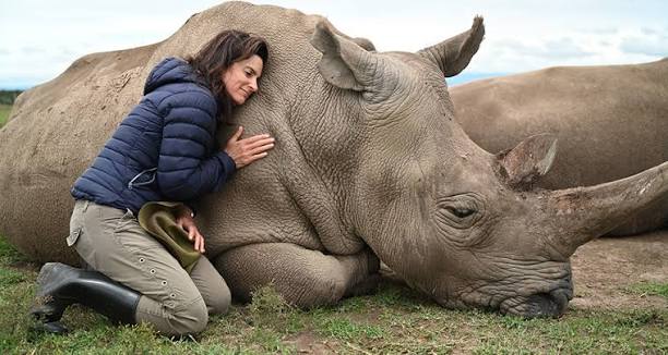 Notice what almost every property has in common? Cattle ranch becomes wildlife conservancy becomes globally celebrated conservation model. The transformation is consistent, and it has been, whatever its environmental merits, politically advantageous for the families involved.
By rebranding as conservation, these estates have achieved something the original 999-year leases could never have guaranteed on their own: international moral legitimacy. Challenge a cattle ranch and you are challenging an economic arrangement. Challenge a rhino sanctuary — one that hosts the world’s last northern white rhinos and receives international conservation funding and celebrity attention — and you risk being framed as an opponent of wildlife protection itself.
Kenyan land scholar Ambreena Manji, Professor of Land Law and Development at Cardiff University and author of The Struggle for Land and Justice in Kenya, has documented this dynamic from the legal side. Her central finding, after years studying Kenya’s post-2010 land reforms, is that the reforms have been “more concerned with the administration of land and with bureaucratic power than with the real consequences of unequal access to land for ordinary Kenyans.”
The question is not whether rhinos should be protected. The question is who owns the land on which they live, what claim the communities displaced to create that land have on its future, and whether “conservation” has become, in Kenya, a durable new form of the same old arrangement — land in foreign or settler-descended hands, now justified by an appeal to global environmental good rather than to imperial right.
Notice what almost every property has in common? Cattle ranch becomes wildlife conservancy becomes globally celebrated conservation model. The transformation is consistent, and it has been, whatever its environmental merits, politically advantageous for the families involved.
By rebranding as conservation, these estates have achieved something the original 999-year leases could never have guaranteed on their own: international moral legitimacy. Challenge a cattle ranch and you are challenging an economic arrangement. Challenge a rhino sanctuary — one that hosts the world’s last northern white rhinos and receives international conservation funding and celebrity attention — and you risk being framed as an opponent of wildlife protection itself.
Kenyan land scholar Ambreena Manji, Professor of Land Law and Development at Cardiff University and author of The Struggle for Land and Justice in Kenya, has documented this dynamic from the legal side. Her central finding, after years studying Kenya’s post-2010 land reforms, is that the reforms have been “more concerned with the administration of land and with bureaucratic power than with the real consequences of unequal access to land for ordinary Kenyans.”
The question is not whether rhinos should be protected. The question is who owns the land on which they live, what claim the communities displaced to create that land have on its future, and whether “conservation” has become, in Kenya, a durable new form of the same old arrangement — land in foreign or settler-descended hands, now justified by an appeal to global environmental good rather than to imperial right.
How Independence Protected Settler Wealth: The Betrayal at Lancaster House
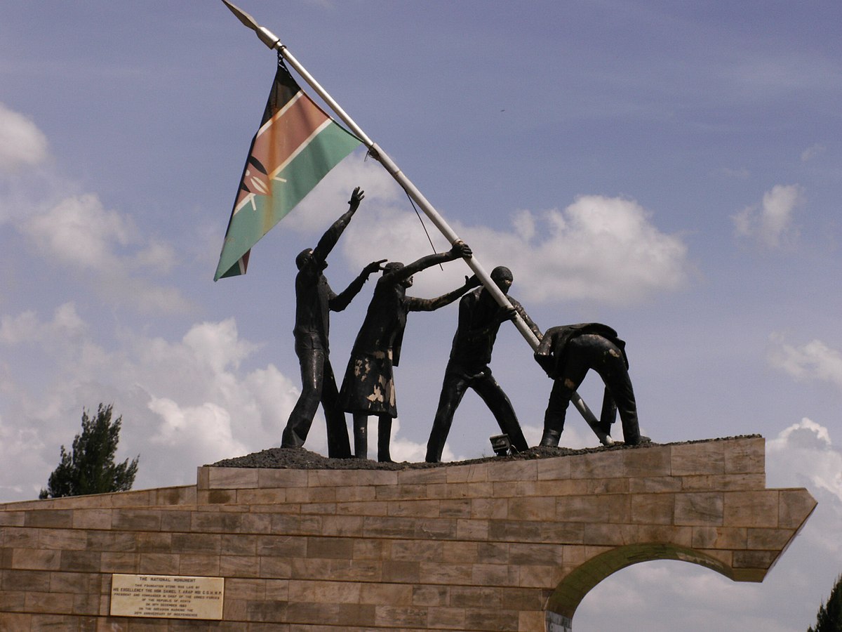 If the land was so obviously and violently stolen, why didn’t independence fix it?
By 1960, the pressure was building to a point that threatened to make the transition to independence violent. The Mau Mau uprising, the Kenya Land and Freedom Army, was causing disruptions to British rule. African nationalist resentment of the White Highlands was the single most combustible political force in the country. The British government, facing the political mathematics of African majority rule, knew that whatever came next, it could not simply hand power to an African government and leave the land question unresolved.
The solution Britain devised was land purchase, at market rates, on the settlers’ terms.
In 1962, as Kenya moved toward independence through a series of constitutional conferences at Lancaster House in London, the colonial administration launched what became known as the Million Acre Settlement Scheme. Backed by loans from the British government and the World Bank, the scheme aimed to buy land from willing settlers and resettle African smallholders, with three goals: to redistribute land, maintain agricultural output, and preserve peace. The key word there was “willing.” No settler would be compelled to sell. Those who chose to stay could stay. Those who chose to sell would be paid market rates and the buyers, the new African smallholders, would repay that cost themselves. Although one third of the purchase price was met by UK grants, the farmer had to repay the balance over 30 years.
This is the arrangement that has largely defined Kenya’s land tenure ever since, and its logic deserves to be examined. Britain did not pay reparations for stolen land. They offered to help purchase, at market value, some of the land its settlers had originally acquired through force, fraud, and treaty violation, and then required the displaced Africans who bought it to pay most of that market value back, over three decades, in loan repayments. Kenyans were made to buy back their own land on credit with high interest rates.
A little over one million acres owned by 780 white farmers was eventually purchased. By the time the scheme wound down in 1971, around 35,000 families had been settled on 1.2 million acres. By the mid-1980s, including additional squatter settlement schemes, around 71,000 families had been settled on nearly 2 million acres, about 17% of all land originally held by white farmers. Only seventeen percent, after two decades of what was presented as Kenya’s great land reform, that is all that changed hands. 83% of the original White Highlands remained exactly where it had always been.
The former Scheduled Areas, the “White Highlands,” covered approximately 7.4 million acres in total. After two decades of the most significant land redistribution programme in Kenyan history, 83% of that original settler landholding remained untouched. The families who chose not to sell, or whose land was not included in the scheme’s boundaries, kept their estates. Their 999-year leases continued. The ranches of Laikipia, Soysambu, Ol Pejeta, Lewa, Lolldaiga, Borana, were not part of the scheme. They exist today because no mechanism, legal or political, ever required them to close down.
The scheme only helped to further stratify African society. The European farmers wanted their environment to be left undisturbed, while the main issue of landlessness and squatting was not addressed.
What the scheme did instead was to serve as a vehicle for elite capture by the new African political class. Under the Yeomen component of the scheme, financed by the World Bank, a small number of elite Africans were to receive around 5,000 acres each, farming alongside whites. When that arrangement collapsed, it inspired what became known as the Z-Plot scheme under the Jomo Kenyatta administration, under which political elites allocated themselves colonial farmhouses and 100 acres each on land nominally meant for resettlement. The mechanism of dispossession had changed hands. Land that was supposed to go to landless Kenyan farmers went instead to ministers, politicians, and their relatives, a pattern that the 2004 Ndung’u Commission would later document in devastating detail.
The Ndung’u Report, officially the Report of the Commission of Inquiry into the Illegal and Irregular Allocation of Public Land, commissioned by President Kibaki and presented in 2004, is one of the most important and most ignored documents in Kenyan history. It found that over 200,000 illegal or irregular land allocations were made between 1962 and 2002, involving public lands and trust lands, with public land allocated to relatives, friends, and political supporters of successive governments without adherence to legal procedures. In a stinging indictment of Presidents Jomo Kenyatta and Daniel arap Moi, the commission cited abuse of presidential discretion in the allocation of government land as central to the land-grabbing spree by politicians, their cronies, and relatives.
Recommendations to repossess all grabbed public land, seize proceeds of ill-gotten wealth, and prosecute rogue public officials have never been fully implemented in the over two decades since the report was submitted.
This is the complete picture that the Million Acre Scheme’s official history tends to obscure. The scheme was the mechanism through which Britain bought its settlers enough time to leave on their own terms, settled a small fraction of landless Kenyans to prevent a social explosion, transferred the cost of that settlement to the Kenyans themselves, and left the large estates, those that have always been the heart of the land question, entirely intact. And into the political vacuum that the scheme’s inadequacy created, Kenya’s new governing elite inserted itself, replicating in miniature the same pattern of allocation without accountability, dispossession without remedy, that the colonial system had perfected over six decades.
This system extended beyond land. To this day, the Kenyan state still pays pensions of British colonial officers. These people retired in 1963. Kenya’s own Auditor General has repeatedly flagged that no verified life certificates have been submitted to confirm they are still alive, yet the payments continue. In the 2022-2023 financial year alone, Kenya paid Ksh 150 million ($1.16 million) to the retirees and a further Ksh 112 million ($866,537) to the widows of deceased colonial workers.
If the land was so obviously and violently stolen, why didn’t independence fix it?
By 1960, the pressure was building to a point that threatened to make the transition to independence violent. The Mau Mau uprising, the Kenya Land and Freedom Army, was causing disruptions to British rule. African nationalist resentment of the White Highlands was the single most combustible political force in the country. The British government, facing the political mathematics of African majority rule, knew that whatever came next, it could not simply hand power to an African government and leave the land question unresolved.
The solution Britain devised was land purchase, at market rates, on the settlers’ terms.
In 1962, as Kenya moved toward independence through a series of constitutional conferences at Lancaster House in London, the colonial administration launched what became known as the Million Acre Settlement Scheme. Backed by loans from the British government and the World Bank, the scheme aimed to buy land from willing settlers and resettle African smallholders, with three goals: to redistribute land, maintain agricultural output, and preserve peace. The key word there was “willing.” No settler would be compelled to sell. Those who chose to stay could stay. Those who chose to sell would be paid market rates and the buyers, the new African smallholders, would repay that cost themselves. Although one third of the purchase price was met by UK grants, the farmer had to repay the balance over 30 years.
This is the arrangement that has largely defined Kenya’s land tenure ever since, and its logic deserves to be examined. Britain did not pay reparations for stolen land. They offered to help purchase, at market value, some of the land its settlers had originally acquired through force, fraud, and treaty violation, and then required the displaced Africans who bought it to pay most of that market value back, over three decades, in loan repayments. Kenyans were made to buy back their own land on credit with high interest rates.
A little over one million acres owned by 780 white farmers was eventually purchased. By the time the scheme wound down in 1971, around 35,000 families had been settled on 1.2 million acres. By the mid-1980s, including additional squatter settlement schemes, around 71,000 families had been settled on nearly 2 million acres, about 17% of all land originally held by white farmers. Only seventeen percent, after two decades of what was presented as Kenya’s great land reform, that is all that changed hands. 83% of the original White Highlands remained exactly where it had always been.
The former Scheduled Areas, the “White Highlands,” covered approximately 7.4 million acres in total. After two decades of the most significant land redistribution programme in Kenyan history, 83% of that original settler landholding remained untouched. The families who chose not to sell, or whose land was not included in the scheme’s boundaries, kept their estates. Their 999-year leases continued. The ranches of Laikipia, Soysambu, Ol Pejeta, Lewa, Lolldaiga, Borana, were not part of the scheme. They exist today because no mechanism, legal or political, ever required them to close down.
The scheme only helped to further stratify African society. The European farmers wanted their environment to be left undisturbed, while the main issue of landlessness and squatting was not addressed.
What the scheme did instead was to serve as a vehicle for elite capture by the new African political class. Under the Yeomen component of the scheme, financed by the World Bank, a small number of elite Africans were to receive around 5,000 acres each, farming alongside whites. When that arrangement collapsed, it inspired what became known as the Z-Plot scheme under the Jomo Kenyatta administration, under which political elites allocated themselves colonial farmhouses and 100 acres each on land nominally meant for resettlement. The mechanism of dispossession had changed hands. Land that was supposed to go to landless Kenyan farmers went instead to ministers, politicians, and their relatives, a pattern that the 2004 Ndung’u Commission would later document in devastating detail.
The Ndung’u Report, officially the Report of the Commission of Inquiry into the Illegal and Irregular Allocation of Public Land, commissioned by President Kibaki and presented in 2004, is one of the most important and most ignored documents in Kenyan history. It found that over 200,000 illegal or irregular land allocations were made between 1962 and 2002, involving public lands and trust lands, with public land allocated to relatives, friends, and political supporters of successive governments without adherence to legal procedures. In a stinging indictment of Presidents Jomo Kenyatta and Daniel arap Moi, the commission cited abuse of presidential discretion in the allocation of government land as central to the land-grabbing spree by politicians, their cronies, and relatives.
Recommendations to repossess all grabbed public land, seize proceeds of ill-gotten wealth, and prosecute rogue public officials have never been fully implemented in the over two decades since the report was submitted.
This is the complete picture that the Million Acre Scheme’s official history tends to obscure. The scheme was the mechanism through which Britain bought its settlers enough time to leave on their own terms, settled a small fraction of landless Kenyans to prevent a social explosion, transferred the cost of that settlement to the Kenyans themselves, and left the large estates, those that have always been the heart of the land question, entirely intact. And into the political vacuum that the scheme’s inadequacy created, Kenya’s new governing elite inserted itself, replicating in miniature the same pattern of allocation without accountability, dispossession without remedy, that the colonial system had perfected over six decades.
This system extended beyond land. To this day, the Kenyan state still pays pensions of British colonial officers. These people retired in 1963. Kenya’s own Auditor General has repeatedly flagged that no verified life certificates have been submitted to confirm they are still alive, yet the payments continue. In the 2022-2023 financial year alone, Kenya paid Ksh 150 million ($1.16 million) to the retirees and a further Ksh 112 million ($866,537) to the widows of deceased colonial workers.
When Kenyans Fought Back
In 2017, armed herders moved their cattle onto large ranches across Laikipia in what was infamously referred to as “land invasions.” The immediate trigger was a severe drought that had pushed pastoralist communities from Baringo, Samburu, and Pokot counties to act. The underlying cause was six decades of exclusion from grazing land that had, in living memory, been open range.
The international media covered the 2017 invasions primarily as a story of violence against landowners. Kuki Gallmann, who owned the 98,000-acre Laikipia Nature Conservancy, was shot and seriously wounded on her property while surveying fire damage with Kenya Wildlife Service rangers. Weeks earlier, Tristan Voorspuy, a British military veteran and co-founder of a prominent Laikipia safari company, was shot dead while inspecting a ranch property that had been burned during the unrest.
The Kenyan government likewise condemned the violence, emphasizing its criminal nature while giving less attention to the historical grievances over land dispossession and exclusion that formed the backdrop to the unrest. This is the structural bind of Kenyan politics on the land question: the rhetoric of historical injustice is widely available and frequently used during political campaigns, but when displaced communities act on that injustice, rather than waiting for legal processes that have moved at a slow pace for over a century, the response from the political class, across the spectrum, has always leaned toward restoring order rather than addressing the underlying claim.
The government’s response to the “invasions” was to deploy security forces to protect the ranches. The underlying grievances were not resolved. They bubbled to the surface in 2026, in the same county, over a different but structurally related dispute — the US Ebola facility at Laikipia Air Base, where two Kenyans were shot and killed while protesting against construction of the facility.
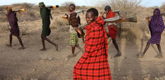
Credit: ISS Africa
Lolldaiga: The Cover-Up
If there is one story that, more than any other, exposes the relationship between Britain’s continued military presence in Laikipia and the land question underlying it, it is Lolldaiga.
In March 2021, a British military training exercise at the Lolldaiga Hills Conservancy, adjacent to BATUK’s training grounds, sparked a wildfire. According to local media’s documentation of the incident, the fire was started by soldiers during a training exercise and burned approximately 12,000 acres of land. One man, Linus Murangiri, was crushed to death by a vehicle while helping fight the blaze. Elderly residents suffered eye injuries and a baby was hospitalised for smoke inhalation.
What happened next became almost as significant as the fire itself. During the court proceedings that followed, some of the soldiers involved were alleged to have been intoxicated at the time. And in the aftermath, a British soldier posted on social media, reported by the BBC, joking about the incident, “Two months in Kenya later and we’ve only got eight days left. Been good, caused a fire, killed an elephant and feel terrible about it but hey-ho, when in Rome.”
For years, the British government’s position was that it held immunity from civil claims in Kenyan courts. That position collapsed in 2025. Over 7,700 Kenyan residents, represented in a class-action suit before the Environment and Land Court, won a landmark ruling from High Court Judge Kossy Bor, who found that the UK had surrendered its absolute immunity from civil suits the moment it entered into a defence cooperation treaty with Kenya. It was the first time Kenyan courts had been able to try civil claims against British military forces, a genuinely historic legal breakthrough, more than a century after the legal architecture that protected colonial and post-colonial impunity in Kenya was first constructed.
The British government did not contest the underlying facts. A spokesperson for the British High Commission in Nairobi stated that the UK “accepts responsibility for the fire and that is why compensation has been paid… it is the right thing to do.” In August 2025, the UK agreed to pay £2.9 million, roughly $4 million, to over 7,000 affected residents.
Divided among the claimants, that settlement amounts to approximately 22,500 Kenyan shillings per person, about $174. Local resident Charles Ndungu, who told reporters his home was closest to the fire and that he had personally helped fight it, called the payout “shocking.” Residents had sought £575 million collectively. They received roughly 0.5% of that figure.
There is one more layer to Lolldaiga that connects it directly to the broader argument of this article. During the litigation, the British army admitted to having used white phosphorus, an incendiary chemical weapon, during training exercises in the area, and residents have linked its use to the fire and to ongoing health problems, including respiratory issues, eye damage, and reports of miscarriages in both humans and livestock in the surrounding community. The British Army’s official position has been that white phosphorus illuminant rounds are not considered dangerous when safety precautions are followed, and that they are fired only in a designated, gazetted training area rather than on communal land. The residents living downstream and downwind of that training area, drinking from a river they say has run “dark murky brown” since the fire, experience the distinction differently.
Lolldaiga is not, in itself, a story about who owns the land. The conservancy’s 49,000 acres remain, as they have for generations, under the management of descendants of the colonial family that first claimed them. But Lolldaiga is a story about what happens on contested colonial land when the people who actually live around it are the ones who bear the cost. A fire that took two weeks to extinguish, an environmental assessment that found the damage would take 30 to 50 years to fully repair, a chemical weapon used on training grounds adjacent to where children walk to school, and, at the end of a four-year legal battle that represented a genuine and historic breakthrough in accountability, a settlement of $174 per person.
This is the same county where, in June 2026, the Ruto government agreed to let the United States build an Ebola quarantine facility for Ebola-exposed American citizens without consulting anyone who lives there.
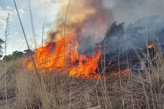
Credit: Daily Nation
The Unfinished Independence
In 2010, Kenya adopted a new Constitution that was, among many other things, an explicit attempt to close the door on exactly this kind of permanent foreign landholding.
Article 65 of the 2010 Constitution states that a non-citizen may hold land only on leasehold tenure, and that any such lease cannot exceed 99 years. The Constitution further stated that a company is only treated as Kenyan, and therefore exempt from the 99-year cap, if it is wholly owned by Kenyan citizens. Even a single foreign shareholder is enough to convert a company into a “non-citizen” for purposes of land law.
On paper, it was a sort of revolution. It meant that, as of 2010, every 999-year colonial lease still in foreign hands had effectively been slashed by 900 years overnight, with a clause that when the lease ends, the land would be taken over by the state.
However, close to three decades later, the estates found a way to beat the system: they’re still under the same families, operating largely as before.
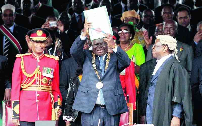
Credit: Standard Newspaper
Loophole on a Technicality
The gap between the constitutional text and the situation on the ground is a product of deliberate legal strategy by the families and corporations whose landholdings Article 65 was written to address. The most direct route was citizenship. Article 65’s restrictions apply to non-citizens. Third- and fourth-generation descendants of British settlers, families who have lived in Kenya for over a century, who in many cases hold no meaningful ties to Britain beyond ancestry, were able to formalise their “Kenyanness.” Their interpretation was that a family that has farmed the same land since 1906 and whose members were born in Kenya is not, in any straightforward sense, “foreign” under Kenyan law, however colonial the origins of their landholding. Citizenship converted a 999-year colonial grant from a foreign-ownership problem that Article 65 was designed to solve into a citizen-ownership arrangement that the article is silent about. Therefore the land question became, legally speaking, invisible. For the larger corporate landholdings, agribusiness operations rather than family estates, the strategy has been different but related. Del Monte Kenya, the multinational fruit processor, controls over 22,000 acres across Murang’a and Kiambu counties under leases that trace back to the colonial period. As those leases approached expiry, county governments and local advocacy groups pushed the National Land Commission to decline renewal requests unless the company surrendered a significant portion of the land, between 6,000 and 10,000 acres, for public use, including resettling local families who have lived as squatters on the margins of the estate for generations. Del Monte fought this for years through the courts, arguing that its economic contribution and the scale of its investment created a “legitimate expectation” of automatic renewal, an argument that, if accepted, would have meant Article 65’s reversion clause existed only in theory, never in practice, for any landholder large enough to make the argument. Kenya’s Supreme Court has, in recent years, taken an increasingly firm line on expired public land leases, ruling in April 2025, in a case concerning a residential plot in Nairobi’s Ngara neighbourhood, that a lease which expires without renewal reverts automatically to the government, regardless of how long the occupant remains in possession. That principle, if it were ever applied to the great Laikipia ranches and their colonial-era leases, would be enormously consequential. No court has tested Article 65’s 99-year cap, or the reversion principle, against Soysambu, Ol Pejeta, Lewa, or any of the other large estates documented here. No citizenship-loophole challenge has been brought against the families who converted colonial grants into permanent Kenyan ownership. The legal tools to unwind these holdings exist, at least in principle, in the Constitution’s own text. They remain, for now, untested where it would matter most. All in all, the White Highlands are still white. Erick Gavala is a Nairobi-based political and social commentator.
From Sovereign Media via This RSS Feed.