

Serap Erdal stopped at a light pole in Chicago’s Grant Park, pulled out her phone, and began pinching at the screen. Behind her, towering skyscrapers cut into a sunny blue sky as she scanned her palm-sized map of the city. The researcher barely noticed the hum of city buses, cars, and cyclists buzzing around her in the city’s busy downtown. She was working out what was in the cool summer air.
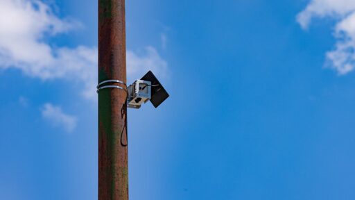
Fixed to the pole above her was one of the city’s new solar-powered air quality monitors. The tracker, encased in a metallic silver shell about the size of a tissue box, is part of the nation’s largest community air quality monitoring network. Today, the network has 277 air monitors across Chicago collecting air pollution data from every ward and community area, with an increased concentration in already-overburdened neighborhoods.
A bright green dot flashed on Erdal’s phone. She smiled.
“Currently, the air quality index at this location is 31,” said Erdal, a professor of environment and occupational health sciences at the University of Illinois Chicago. The reading puts the air quality in the city’s public park in the Environmental Protection Agency’s safest category, meaning it poses little to no risk to public health. “Because we have a clear day and it’s breezy, concentrations across the city are quite uniform,” she added.
On that day in June, almost all of the city’s monitors were green, except for one on the far South Side, where legacy industrial facilities and freight traffic pump emissions into nearby Black and Latino neighborhoods. In the coming years, the monitoring system is expected to elucidate the dramatically uneven air quality in different neighborhoods, even on clear and breezy days.

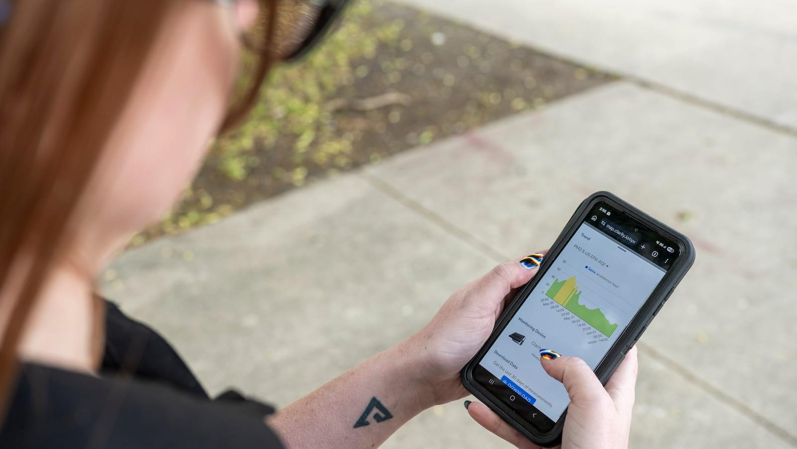
Serap Erdal shows the Open Air Chicago map on her phone. Erdal helped launch the project last fall. Tyler Pasciak LaRiviere / Chicago Sun-Times
The project, called Open Air Chicago, went live last fall and is part of a five-year project to collect hyperlocal air quality data and provide Chicagoans with real-time pollution information. The data is also intended to help officials develop guidance for permitting, urban planning, and air quality control. The network is about to face its first Chicago summer, when air pollution typically worsens. Pollution from cars, heavy vehicles, and industry reacts with sunlight and heat, forming ground-level ozone, a harmful pollutant and the key ingredient in smog, in the summer. As climate change makes summers longer and hotter, the conditions for smog formation are also becoming more common.
The monitoring effort originated as a result of a fight over the city’s decision to relocate General Iron’s scrap-metal shredding operation from the mostly white Lincoln Park neighborhood to the predominantly Latino and Black Southeast Side. In 2021, local environmental activists filed a civil rights complaint with the federal Department of Housing and Urban Development, arguing that the move discriminated against low-income communities of color and harmed their health.
The city and the community groups reached a settlement in 2023, which included launching the community air monitoring network. Chicago officials partnered with the University of Illinois Chicago to launch it last fall at a combined cost of over $4 million to cover operations through the beginning of 2030.
“This air monitoring system is creating an ongoing record of what the air quality is in Chicago,” said Oscar Sanchez, the director of the Southeast Environmental Task Force, one of the groups that successfully filed the civil rights complaint.
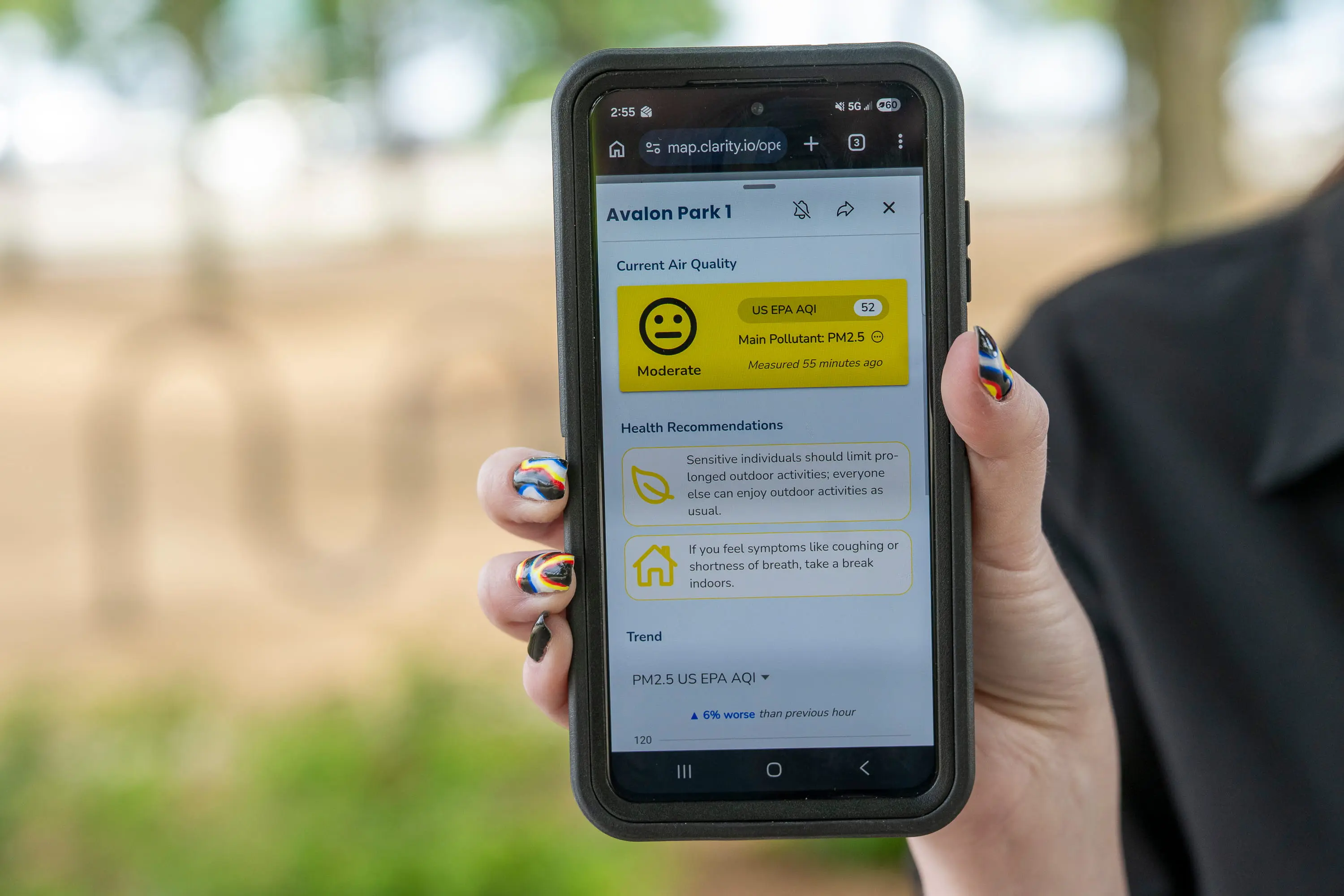
The air quality index in the South Side Avalon Park neighborhood was the highest across the city on June 1.
Tyler Pasciak LaRiviere / Chicago Sun-Times
South and West Side residents have so far had limited ways to corroborate that their air is unsafe. Although they tend to have higher rates of respiratory issues, they lacked time-stamped data to establish connections between their poor health and the region’s air quality. Sanchez said the monitoring system changes that.
“This is Chicago working in good faith,” he said. “We’re here to ensure that there’s publicly available information so people are not gaslit about their experience.”
Each air monitor is less than a mile from the next. The low-cost equipment measures ground concentrations of two airborne pollutants: nitrogen dioxide, typically formed by the combustion of fossil fuels, and PM2.5, which are small particles just one-twentieth the width of a single human hair and capable of passing through a person’s respiratory system and entering the bloodstream. Exposure to both pollutants is linked to childhood asthma and cardiovascular issues. PM2.5 is increasingly being singled out as the world’s leading environmental health-determining factor — associated with acute mortality and morbidity for respiratory and cardiovascular health outcomes.
Even as air quality has improved in recent decades, it can still reach unhealthy levels during the summer when sunlight and warm temperatures react with pollutants in the air to form ground-level ozone. That seasonal smog can further degrade air quality when it mixes with smoke from increasingly frequent wildfires. Climate change is exacerbating these conditions in the Midwest, according to Daniel Horton, an assistant professor of Earth and planetary sciences at Northwestern University.
“We also have to deal with the consequences of increased frequency and intensity of wildfires,” Horton said. “That’s a problem that doesn’t necessarily occur in our backyards, but when the wind blows in the right direction, we suffer the consequences in the Midwest.”
Read Next
Wildfire smoke engulfed their cities. Did it make their babies sick?
Wildfire smoke now dependably turns Chicago’s summer skies into a hazy orange. In 2023, smoke from the record-setting Canadian wildfires reached the Windy City and raised ground-level ozone levels by nearly 10 percent of the federal pollution limit, according to a study published earlier this year. The study also found that central, western, and southeastern neighborhoods in Chicago were most impacted by ozone.
So far, wildfires have already burned through 2.5 million acres nationwide. That’s nearly double the 10-year average for this time of year. The recent surge in wildfires, tied in part to climate change, is reversing the country’s steady progress toward improving air quality, according to a recent study published earlier this month in Science.
Between 2003 and 2015, the study found that stricter federal air quality rules successfully cut down on the toxic gases that form ozone, or smog, by approximately 11 percent. Since 2015, however, rising ozone levels have undone about a third of the nation’s headway toward cleaner air — translating to an increase of 318 premature deaths per year from wildfire-related ozone since 2013.
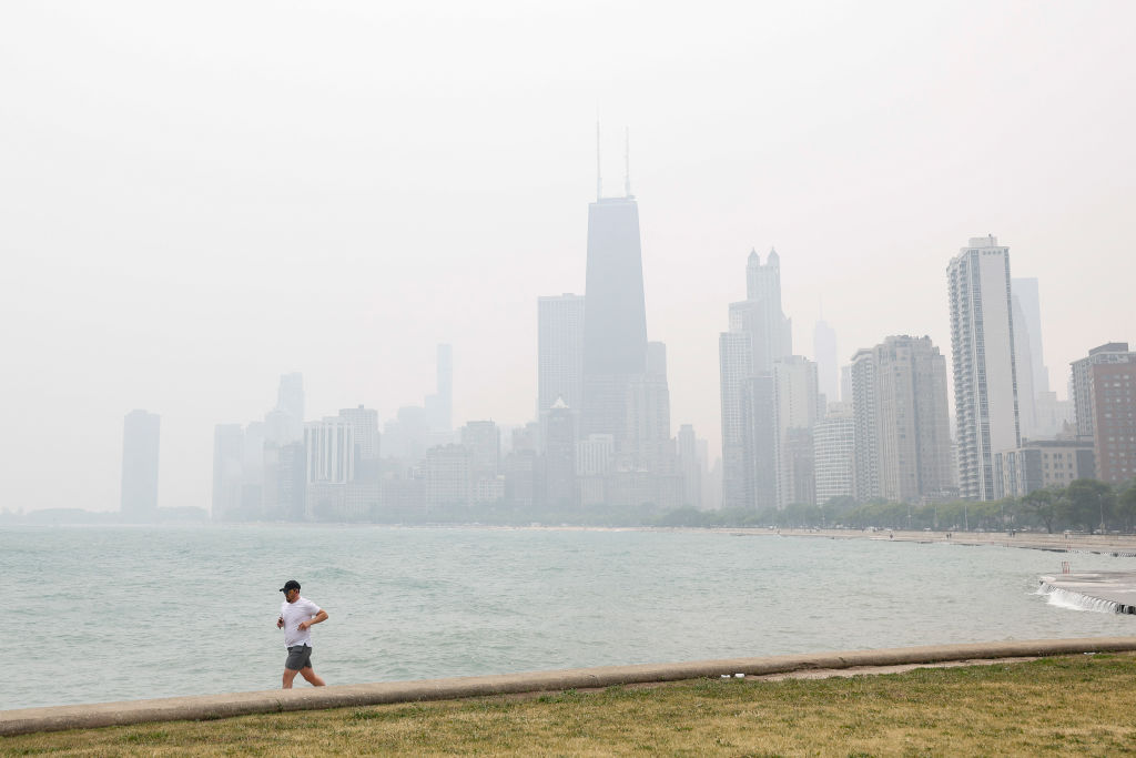
A jogger runs along the shoreline of Lake Michigan, with heavy smoke from the Canadian wildfires in the background, in June 2023.
Kamil Krzaczynski / AFP via Getty Images
As extreme heat reshapes air pollution in the Midwest and across the country, Horton said the Open Air Chicago network will be able to identify localized pollution hot spots, offering an “unprecedented look at the air quality landscape across the city.”
The local network is expected to build on top of existing data collected by NASA satellites and the EPA’s limited number of regulatory-grade air monitoring sensors, which Horton called the “gold standard.” While the EPA’s more sophisticated monitoring devices provide precise measurements of pollutants like PM2.5 and nitrogen dioxide, they are also more expensive to maintain. Chicago’s low-cost sensors, although less precise, capture over 20,000 data points per day. The sheer volume of data is expected to yield major findings about how air quality changes across the city.
Carl Malings, an assistant research scientist at Morgan State University and NASA Goddard Space Flight Center, said the local data is especially important because, in many cases, satellites are capturing an aerial view that combines the messy interplay of particles and gases throughout the atmosphere’s layers, making it difficult to untangle what’s in the air people breathe near the surface of the Earth.
“If you see a smoke plume from satellite data in the absence of other information, it could be hard to say, Is that smoke actually reaching down to the surface, where it’s impacting air quality and people’s health, or is it rising a little bit above the surface and passing overhead?” Malings said.
Grace Adams, project administrator at the Chicago Department of Public Health, looks at one of the individual air sensor readouts on her phone. Tyler Pasciak LaRiviere / Chicago Sun-Times
Back in downtown Chicago, Erdal said the program is expected to run through 2029. City officials hope to keep the network online even longer. Over the noisy downtown traffic, she said the network is the culmination of two decades of citizen-based research with communities across the city’s West Side and Southeast Side. Previously, she worked on a project to monitor vehicle emissions in several of the city’s majority-Latino neighborhoods, which included helping local environmental justice activists install low-cost PurpleAir sensors.
Now her big goal is that the data collected over the next five years can help craft a roadmap for city officials and community leaders to cut down Chicagoans’ exposure to unsafe air.
“We hope we’ll strengthen the network in the future,” Erdal said. “Measuring more pollutants and providing more data to the public.”
This story was originally published by Grist with the headline After a civil rights complaint, Chicago built the nation’s largest air monitoring network on Jun 25, 2026.
From Grist via This RSS Feed.