

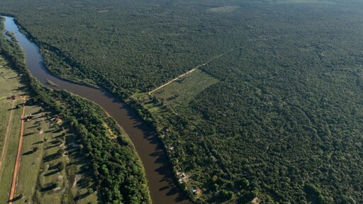
Each year, researchers at the University of Maryland’s GLAD Lab in the U.S. develop one of the most important data sets on global forest loss. The data is derived from NASA and European Space Agency satellite imagery and, in the Amazon Rainforest, often helps environmental groups and government officials make decisions about conservation. The figures for 2025 were published at the end of April, following months of processing and quality checks. But a comprehensive analysis, highlighting year-on-year trends and hotspots, was only recently released by Mapping of the Andes Amazon Project (MAAP), an Amazon Conservation initiative to track forest loss in the Amazon basin. While the data suggests that several metrics for measuring forest loss are down from previous years, they’re still concerningly high overall, researchers said. Agriculture, cattle ranching and mining continue to destroy hundreds of thousands of hectares of primary forest, often in protected areas and Indigenous territory. “I have a hard time saying it’s good news if deforestation is lower than previous years, but was still a million [hectares],” Matt Finer, MAAP director and senior research specialist, told Mongabay. He said it’s far from the zero-deforestation rate needed in the region. A: Soy frontiers of southeast Brazil; B: Soy frontiers of southern Bolivia; C: Trans-Amazonian Highway; D: BR-364; E: Agricultural areas in central Peru; F: Arc of deforestation in northwest Colombia; G: Gold mining areas in southern and central Peru: H: Gold mining areas in northern Ecuador; I: Gold mining areas in Venezuela, Guyana, Suriname; J: Indigenous…This article was originally published on Mongabay
From Conservation news via This RSS Feed.