

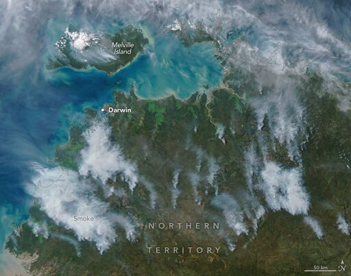
In May and June of most years, NASA satellites typically begin to detect large numbers of wildland fires throughout the Top End and Arnhem Land regions of Australia’s Northern Territory. On some days, especially in the afternoon, the blazes can resemble sizable wildfires in satellite imagery, spreading widely and producing expansive smoke plumes.
From Earth News - Earth Science News, Earth Science, Climate Change via This RSS Feed.
You must log in or # to comment.