

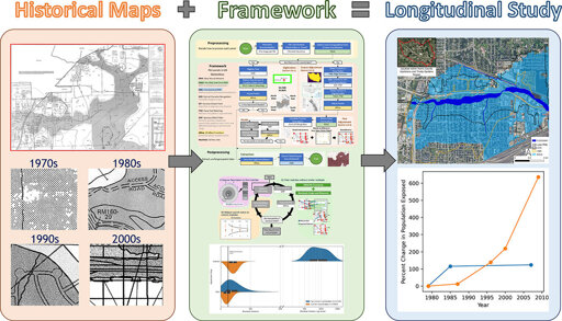
Engineers at the University of Houston have unlocked decades of hidden flood risk data, using artificial intelligence to transform paper flood maps into digital tools that reveal how flooding has evolved—and where future risks are rising. The team developed an AI-driven framework that extracts and georeferences historical Flood Insurance Rate Maps (FIRMs), converting paper records into high-accuracy digital datasets.
From Earth News - Earth Science News, Earth Science, Climate Change via This RSS Feed.
You must log in or # to comment.