

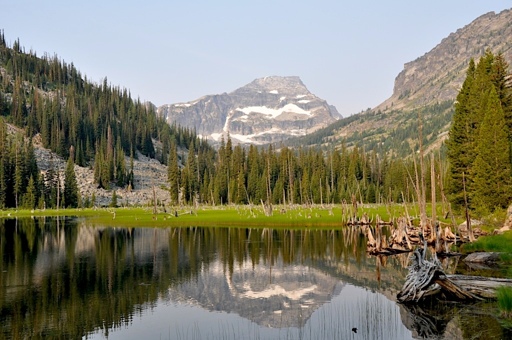
The Selway–Bitterroot Wilderness was part of the original class of lands designated under the United States’ 1964 Wilderness Act: 1.3 million acres, or about 526,000 hectares, of steep river canyons, cold subalpine ridges, dense forest, and weather so unforgiving it shapes everything that survives there. It remains one of the most remote places in the continental U.S. The Selway offers a window into a broader global pattern: ecosystems that appear intact from afar are already being structurally reshaped by invasive species, climate change and hidden biodiversity loss. The idea of “untouched wilderness” persists in our imagination, but ecologically, it is no longer true. Its remoteness is literal. Trails disappear under the brush that regrows faster than crews can cut it. Fire and blowdowns reshape entire drainages in a year. Maps may show routes, but the land often says otherwise. Without intervention, trails vanish, reclaimed by vegetation and gravity. I know this because I’ve spent days clearing them. By 2016, roughly half the trails shown on topographic maps were already impassable, in a failure for recreation but a quiet triumph for wildlife. There are square miles of habitat here that likely haven’t seen a human in decades. The Selway River is one of the most technically demanding whitewater runs in North America. Rafts flip, boats wrap, and accidents turn fatal almost every year. People call it wilderness because it feels like one. But feeling wild and intact functioning are not the same thing. One of the largest elk herds in the…This article was originally published on Mongabay
From Conservation news via This RSS Feed.