

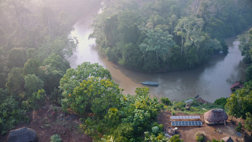
In the southern tip of Colombia’s Cauca department, known as the “boot” for its shoe-like shape, volunteer members of an Indigenous guard patrol their territories in the Andean foothills to protect them from invasion and deforestation. The municipality of Piamonte, which covers most of the boot, suffered the highest loss of forest cover in Cauca between 2001 and 2024, according to data from Global Forest Watch. “There are two fronts: illegal mining by illegal armed groups, and legal mining” by companies with permits, said Edinson Ramos Usnas, a member of the Nasa people and the coordinator of Cauca’s regional guard. “Mining cuts down trees, it destroys the land, it creates pits. This is causing many species, including native tree species, to disappear,” said Gloria Rivera, a Nasa woman from Cauca. This degradation of the forest where the Andes meet the Amazon, a biodiversity hotspot, has impacts that go beyond its immediate surroundings, according to a report by the Science Panel for the Amazon (SPA) looking at landscape connectivity in the Amazon Basin. Ecological connectivity between the rivers, lowlands, wetlands and Andean foothills in the Amazon is essential to guarantee the survival of the rainforest and the ecosystem services it provides. Anthropogenic activities are threatening landscape integrity and therefore connectivity, the research shows, while Indigenous territories and conservation areas are the best barrier against deforestation. This means that supporting Indigenous governance and the integrity of these territories at a transnational level is vital to protect the Amazon as a whole. Where…This article was originally published on Mongabay
From Conservation news via This RSS Feed.