

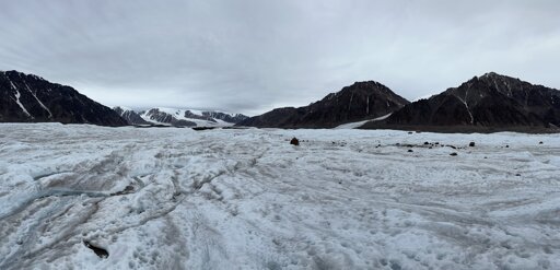
Researchers have created the first map of a network of subglacial lakes in the Canadian Arctic showing 33 bodies of water under glaciers. Using a decade of ArcticDEM satellite data of Earth’s surface height, a team of researchers including the University of Waterloo has developed a method that allowed them to track the draining and filling of active subglacial lakes in unprecedented detail. The team’s paper is published in The Cryosphere.
From Earth News - Earth Science News, Earth Science, Climate Change via This RSS Feed.
You must log in or # to comment.