

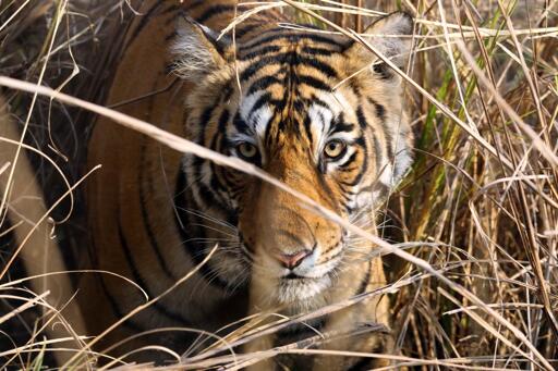
Where are habitats available for threatened species? Are they improving or deteriorating? What landscapes could potentially be used for rewilding animals? A new modeling framework has combined years of remote sensing, field data and inputs from experts to map habitat availability for four species and find answers to these questions. The Act Green project, led by the Wildlife Conservation Society (WCS) and funded by NASA, has used these distinct data sources to visualize not only where species exist at present, but also to predict potential habitats to be considered for restoration and rewilding efforts. The updateable maps can help conservationists and ecologists identify areas that require urgent conservation attention while also pointing them in the direction of intact landscapes where species could be introduced. “We are trying to integrate the richness of expert opinion with remote sensing and modern computational technology to get dynamic maps at very large spatial scales,” Gautam Surya, conservation planning scientist at WCS and co-principal investigator of the project, told Mongabay in a video interview. Mapping a species’ range of habitats is crucial to understand its distribution and assessing where to direct funding for targeted conservation and species reintroduction efforts. It’s even more crucial against the backdrop of the Global Biodiversity Framework, which aims to protect 30% of the world’s ecosystems by 2030, a mission that requires nuanced data on available habitats around the world. “Decision-makers need to figure out how to spend their very scarce resources most effectively and in real time,” Rachel Neugarten, executive…This article was originally published on Mongabay
From Conservation news via This RSS Feed.