

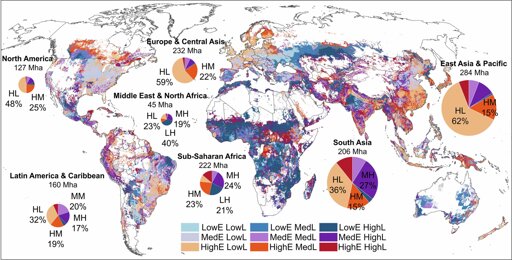
To lower agricultural emissions, policymakers and communities first need to pinpoint the sources—not just by country but crop by crop, field by field. In a study published in Nature Climate Change, researchers have synthesized data from multiple ground sources and models to map global cropland emissions at high resolution—down to about 10 kilometers—while breaking down emissions by crop and source and identifying regions for more precise mitigation.
From Earth News - Earth Science News, Earth Science, Climate Change via This RSS Feed.
You must log in or # to comment.