

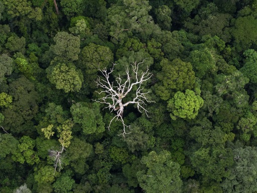
Aerial photography invites a level of uncertainty. The ground offers clues but rarely the full picture. Once the view lifts, certain patterns begin to register: peat-dark water cutting through forest, the abrupt change from canopy to cleared land, the geometry of river bends, or mountains rising in the distance. At times, the colors can be startling. On the ground, the air was thick and hot in the way the lowland tropics often are. The humidity meant I had to be careful with the gear, since lenses can fog quickly when moving from indoors to outdoors. Leaving the drone out, rather than tucked away in a bag, helps. Much of the process is waiting for light or finding the right angle. Clouds on the horizon can flatten everything, or they can break just enough. Weather in the distance may help a shot or force me to pack up early. I spend that time making adjustments, trying to catch a view I didn’t expect when I launched. I often encounter the most interesting views at dawn and dusk. There are boundaries too. Flying a drone does not grant permission to intrude. I keep clear of people, buildings, flight paths, and wildlife. The aim is straightforward: notice what’s there, and leave nothing changed. That approach shaped how I worked in Brunei last month, during a brief trip that allowed me a couple of days in the field. The images here were captured in the Temburong District, a quiet, forested corner of northern Borneo,…This article was originally published on Mongabay
From Conservation news via This RSS Feed.