

Drop Site is a reader-funded, independent news outlet. Without your support, we can’t operate. Please consider making a 501©(3) tax-deductible donation today.
Israel is constructing earth beams alongside yellow blocks hundreds of meters further into Gaza, creating a physical barrier and taking more Palestinian land. (Satellite imagery: Planet Labs PBC).
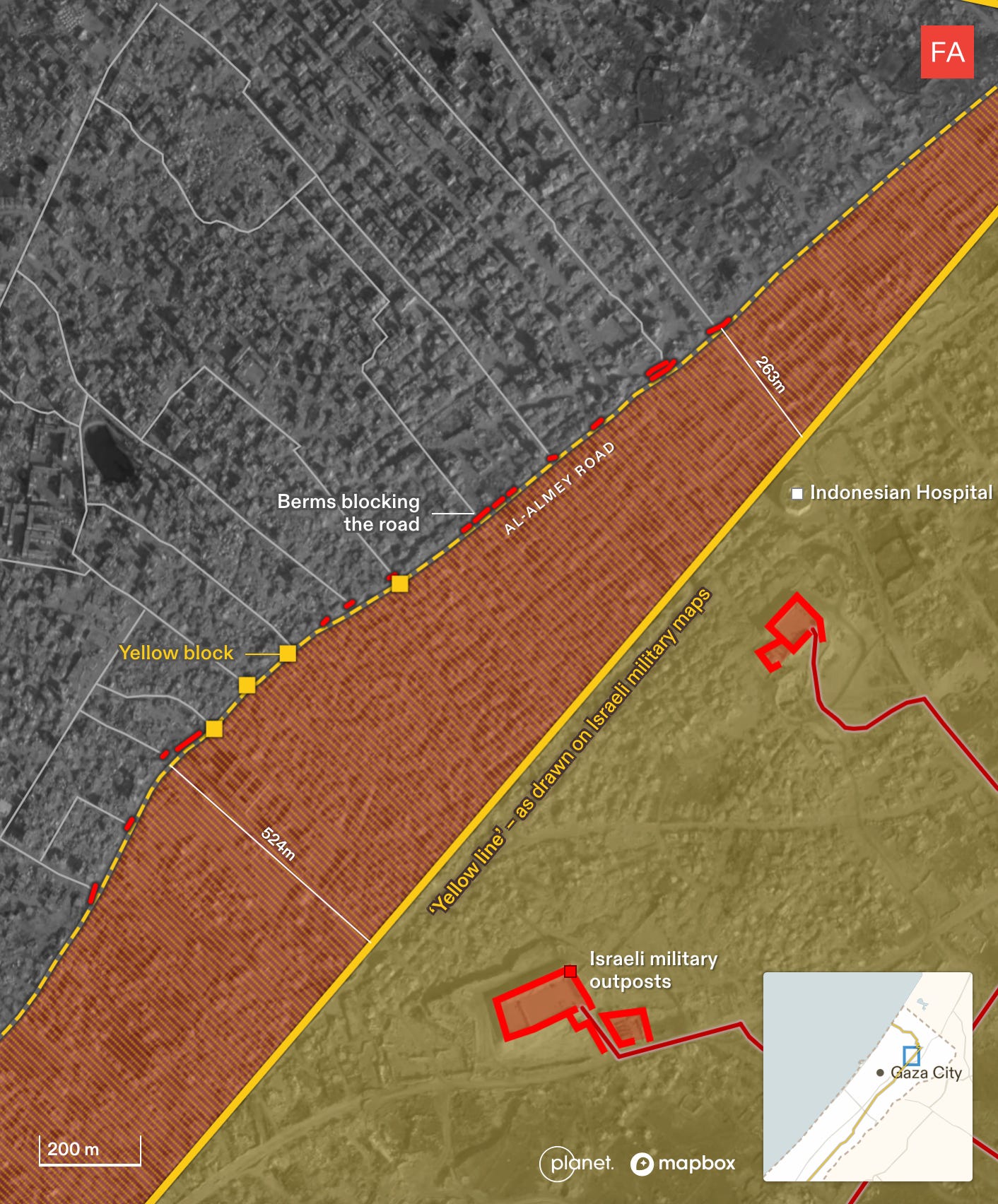
The Israeli military is turning the yellow line that demarcates the more than half of the Gaza Strip it occupies and controls into a physical border. Analysis of satellite imagery by Forensic Architecture shows that the Israeli military has begun constructing earth berms—large, raised mounds of earth—in areas along the yellow line to create a physical separation between the Palestinian population forced to live in the western half of the enclave, and Israeli forces who occupy the eastern half.
Israeli troops withdrew to the yellow line after the so-called ceasefire agreement went into effect on October 10. Since then, they have engaged in a combination of construction of military infrastructure and roads in the over 53% of the territory that it controls—alongside the systematic destruction of existing buildings.
Previously, the yellow line was only drawn in Israeli maps or delineated by the military’s placement of physical yellow blocks—a total of 38 counted by Forensic Architecture—some of which have been moved hundreds of meters further into Gaza in some places, taking over even more Palestinian land.
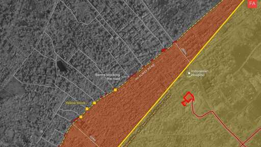
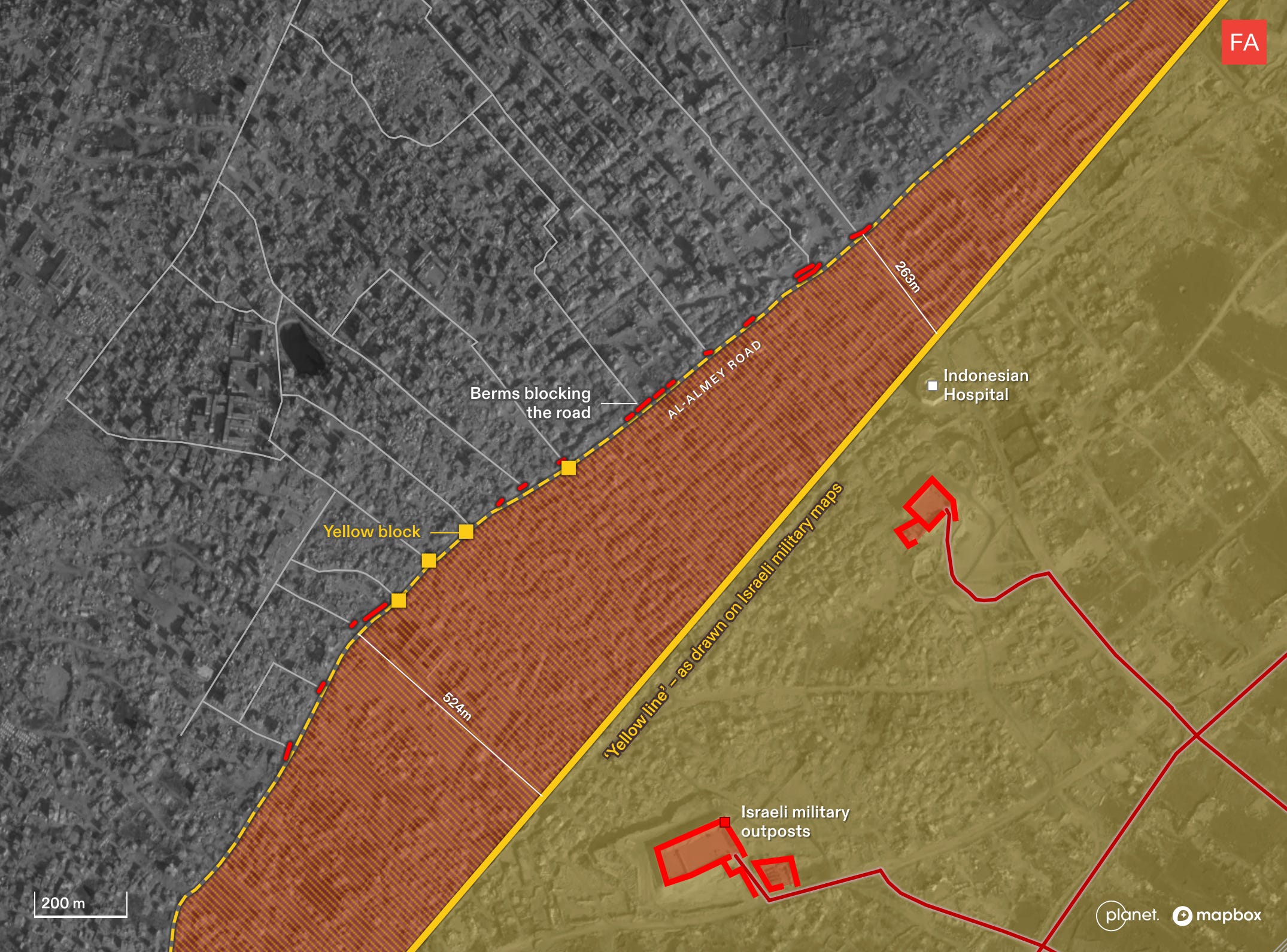
This is the case in Jabaliya, for example, where the berms follow the path of the yellow blocks that Israel has been extending into the area under its control, but beyond the line marked on its own maps. Some of the berms have been constructed across roads, cutting them in half.
The construction of berms along the yellow line, which began last month, is creating a physical barrier that cuts off Palestinians from the Israeli-controlled zone and the rest of Gaza.
Preliminary Analysis by Forensic Architecture
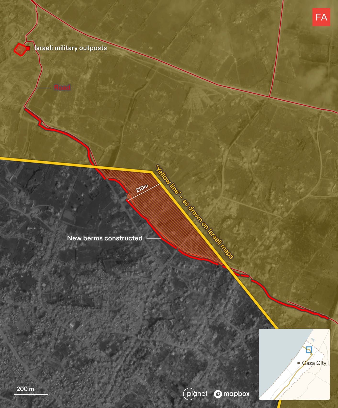
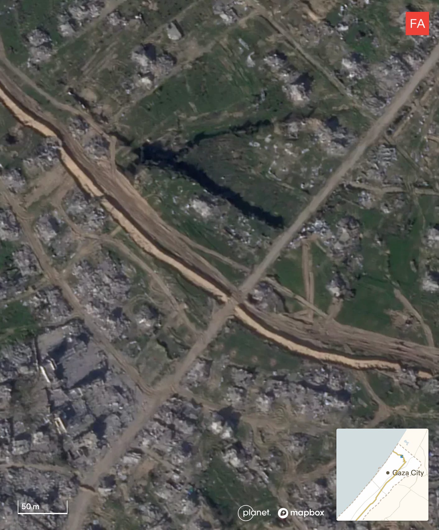
Satellite imagery from January 17, 2026, shows a berm of more than 2 kilometers that has been constructed by the Israeli military along a stretch of the yellow line in Beit Lahia, northern Gaza. It first appeared in an image on December 13, 2025.
(Satellite imagery: Planet Labs PBC).
Close up of new berms constructed in Beit Lahia beyond the yellow line and Israel’s supposed area of control. (Satellite image: Planet Labs PBC).
Israel’s new military infrastructure is effectively extending its military control into Gaza. Satellite imagery from Jabaliya shows that since December, other new berms have been carved along a road parallel to the yellow line. The berms follow the path of the yellow blocks which Israel has been placing, extending the area under its control beyond the line marked on its own maps. Some berms act as roadblocks across streets, blocking Palestinian access.
(Satellite image: Planet Labs PBC).
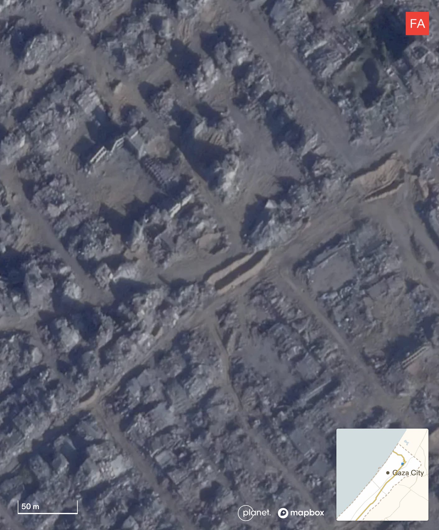
Close-up of new berms constructed in Jabaliya beyond the yellow line and Israel’s supposed area of control. (Satellite image: Planet Labs PBC).
From Drop Site News via This RSS Feed.