

Bullets:
Remote sensing is an earth science that is critical for infrastructure, oil and gas, heavy construction, forestry, and urban planning. Remote sensing is also vital in military applications.
It is the acquisition of information from a distance, and involves advanced sensory equipment placed on satellites, drones, aircraft, and on ships.
For two generations, the United States dominated the industry, because it was the US who invested so heavily in GPS and satellite systems, and built the new science around advanced mapping and surveying.
But beginning ten years ago, Chinese research in the field began to supplant top Western institutions, like NASA, the US Geological Survey, and the top US and European universities.
It is now China who leads the field, with half of the world’s total research, and dominant positions in new patents, research funding, and applied research. And today, Chinese institutions hold the top six spots in rankings for Remote Sensing.
Inside China / Business is a reader-supported publication. To receive new posts and support my work, consider becoming a free or paid subscriber.
For the YouTube video for this report, please click here:
Report:
Good morning.
China has now taken over the Remote Sensing industry. It’s an entire field of science and technology and research and application, and most of us probably even didn’t know it has a name. But it is a crucial industry, and yet another where China leapt ahead of everyone else, before we realized they were in the race at all.
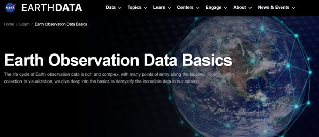
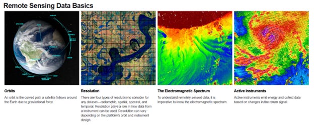
This is from NASA. Remote sensing is the acquisition of information from a distance. NASA has instruments on satellites and spacecraft, and on planes that detect and record energy emissions. The NASA website is pretty cool and explains how the science works.
Remote Sensing is heavily used by the US Geological Survey. Cameras on satellites and planes, and sonar systems on ships, generate maps that are used to fight fires, forecast the weather, track changes in farmland, and see what’s at the bottom of the ocean.
It’s also important in industry, and for the companies who use drones as well as satellites. Benefits here are high degrees of precision, fast and real-time collection of data, even in the most remote areas, and at far lower costs compared to traditional mapping.
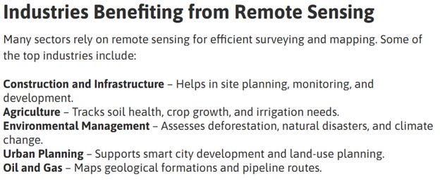
Remote Sensing then is critical in these capital-intensive industries: Construction, infrastructure, ag, city planning, and energy. Building an airport, laying pipelines and deciding where oil rigs are going to go: billions of dollars are at stake, and before they send any crews out, they first need the satellites and drones up to put all their maps together.
And that was why the United States had such an advantage, and for so long. The technology to do all this was expensive, and built at home: the satellites and the GPS systems, the imaging industries. The hardware for it all cost tens of billions of dollars, and the US was the first country to do all that. AI and Machine Learning is going to drive the industry forward from here, and the accuracy will only improve further, while the costs fall.
So even our own experts took it for granted that this was an industry that the US dominated, and would for years to come. But it’s already over. It is China who has invested the most heavily in the latest research. This professor at NYU noticed it ten years ago. It was a given that the top research would come from the best US schools and NASA, but increasingly they were coming from China. Now it’s “a tsunami.”
Before 1990, China didn’t publish any papers in the field, and in the US it was over 90%. By 2000, China was at 4% of the world total, same as India. But by 2023, China was up to half, while the US dropped to under 10%. So China now produces five times more research as the United States, and this shift is one of the most striking examples of the “changes in global technological leadership.”
That’s a big problem, because this industry is growing fast. The market will triple in under ten years, and be worth $1.4 trillion by 2030. Leadership in this field is essential for economic competitiveness, and that leadership has move to China.
For patents in remote sensing, China is now the majority, with over 43,000 in a three-year period. This represents, again, a “dramatic reversal” from the 1990’s when the US was almost all of it. And the machine learning applications are growing exponentially, and China’s low-cost AI is driving a lot of the new research.
It’s also an institutional challenge for the United States. These data are from 2011 to 2020—so they’re over five years old, but by then Chinese institutions had taken the top six positions, out of the top 10. NASA and the National Science Foundation were at 7 and 8, and Europe had the last two. On funding, China’s science foundation spending was over 53% of output, compared to the US at 5%.
China’s remote sensing industry finds itself in a virtuous circle. More funding leads to more researchers leading to more research which means more patents, and higher levels of expertise, and breakthroughs in adjacent sciences, such as in Quantum Technology, and absolute ranging measurements in space.
Those satellites and GPS technologies were the reason the United States led the field. The US had the satellites, built the GPS system, and had the people in places like NASA and NYU to read the instruments and build the science of understanding them. But China also has a space program; we already know they make good industrial drones.

And when China caught up on the hardware, they did so much faster and at far lower price points than anyone expected. In 2022 and 2023, 70% of the satellites China put into the sky were for remote sensing. The percentage dropped slightly last year, because of a boom in launches for satellites of other types, and an industry shift to smaller satellites for the next-generation remote sensing constellations.
Be Good.
Resources and links:
How Remote Sensing is Revolutionizing Surveying and Mapping
https://www.arcsurveyors.com/how-remote-sensing-is-revolutionizing-surveying-and-mapping/
USGS: What is remote sensing and what is it used for?
https://www.usgs.gov/faqs/what-remote-sensing-and-what-it-used
NASA, Earth Observation Data Basics
https://www.earthdata.nasa.gov/learn/earth-observation-data-basics
China commands 47% of remote sensing research, while U.S. produces just 9%
https://phys.org/news/2025-11-china-remote.html
From 88% to 9% – stark data shows US decline, China’s rise in remote sensing research
https://www.scmp.com/news/china/science/article/3333093/88-9-stark-data-shows-us-decline-chinas-rise-remote-sensing-research
China Space in 2024: A Review
[ The China Space Monitor
China Space in 2024: A Review
Dear Readers…
Read more
a year ago · 5 likes · China Space Monitor](https://chinaspacemonitor.substack.com/p/china-space-in-2024-a-review)
Inside China / Business is a reader-supported publication. To receive new posts and support my work, consider becoming a free or paid subscriber.
From Inside China / Business via This RSS Feed.